


State Road A1A in Northeast Florida is a rare coastal drive that still feels like a real journey, not a freeway commute. Between Amelia Island and St. Augustine, with an optional extension to Palm Coast and Flagler Beach, you can string together historic towns, quiet state-park beaches, surf breaks and small beach communities, all without losing sight of the Atlantic for long. This guide focuses on the genuinely strong A1A coastal corridor, helping you decide where to stop, where to sleep, when to leave the scenic byway for faster inland routes, and how to navigate practical details like the St. Johns River Ferry, parking and rental cars.
Understanding the A1A Scenic & Historic Coastal Byway
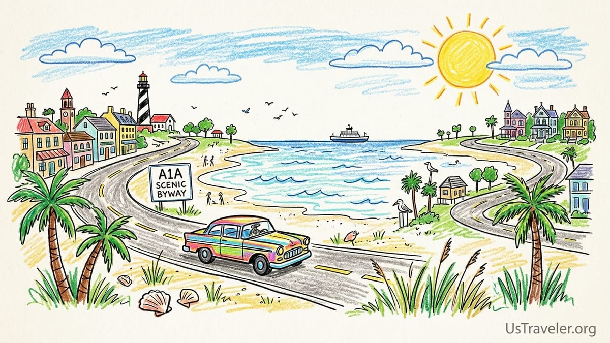
Northeast Florida’s A1A Scenic & Historic Coastal Byway runs for roughly 72 miles through its designated historic and scenic section, from Ponte Vedra Beach south through St. Augustine and along the barrier islands toward Flagler Beach. It is part of a larger A1A network that hugs much of Florida’s Atlantic coast, but this stretch has earned both state scenic highway recognition and National Scenic Byway status for its mix of ocean vistas, historic sites and protected dunes. Typically it is a two-lane road, with speed limits that drop as you enter small communities, which naturally keeps the pace of a road trip unhurried.
North of Ponte Vedra, a separate but complementary scenic route called the A1A Ocean Islands Trail connects Jacksonville’s beach communities with Amelia Island. Many travelers informally treat the whole run from Fernandina Beach on Amelia Island down to Flagler Beach as a single coastal road trip even though it spans more than one official byway designation. In practice, that means you can start on Amelia Island, work south through the Jacksonville Beaches and Ponte Vedra, follow the A1A Scenic & Historic Coastal Byway through St. Augustine, then continue past Marineland to Flagler Beach and Palm Coast without ever needing to jump onto Interstate 95 unless you want to save time.
Driving times can be deceptive. The 70-plus miles from Amelia Island to Flagler Beach might look like a relaxed two-hour drive on a map, but if you are stopping at state parks, beach pull-offs and historic districts, it is very easy to turn this into a two- or three-day journey. Plan your overnight bases in advance, especially on spring and fall weekends and around holidays, when rooms in places like St. Augustine’s historic district or beachfront hotels in Fernandina Beach and Jacksonville Beach can book up quickly.
Because the road passes through wildlife areas and small residential stretches, expect lower speed limits, pedestrian crossings and cyclists along the shoulder. A1A is popular with road cyclists and runners, so this is not a highway for aggressive passing or high speeds. Most rental car drivers find that averaging 35 to 45 miles per hour along the quieter stretches is realistic once you factor in traffic lights and town centers.
Starting Point: Amelia Island and Fernandina Beach
Amelia Island, at the northern tip of Florida just below the Georgia line, makes an excellent starting point for this road trip. Fernandina Beach, the island’s main town, has a walkable historic downtown, Victorian-era homes, and a working waterfront with shrimp boats. Travelers often spend a night here before heading south, choosing from small inns in the historic district or oceanfront resorts on the island’s east side. Room rates vary widely by season; in winter you might see mid-range chain hotels around Fernandina in the 150 to 220 dollars per night range, while summer and holiday weekends can push beachfront resorts well above that.
A1A begins just south of Fernandina Beach and carries you along the length of Amelia Island. Amelia Island State Park sits at the southern end and offers a more natural-feeling beach than the resort-lined stretches closer to town. It has a basic parking area and is a good place for an early-morning beach walk before the day heats up. Roadside parking along the causeway between the Talbot Islands and Amelia Island is restricted in many places, so it is safer to stick to designated lots rather than pulling off on the shoulder.
Many visitors rent a car at Jacksonville International Airport and drive 30 to 40 minutes to Amelia Island to start the trip. The airport has the usual major rental brands, and compact or midsize cars are usually the most practical choice. Convertibles may sound appealing, but sun and sudden showers along the coast can make a regular sedan or small SUV more comfortable, especially if you are carrying beach gear and luggage for several days.
Before you leave Amelia Island, top up on fuel and pick up snacks or picnic supplies in Fernandina Beach. South of the island the drive quickly becomes more rural, and while there are services dotted along A1A, you will enjoy the Talbot Islands and the ferry crossing more if you are not searching for a gas station at the same time.
Talbot Islands and the Wild Stretch of A1A
South of Amelia Island, A1A crosses Nassau Sound and enters a string of largely undeveloped barrier islands known collectively as the Talbot Islands. Big Talbot Island State Park is known for Boneyard Beach, where fallen live oaks and cedars, bleached by salt and sun, create a skeletal driftwood landscape. Access is through park trailheads such as the Blackrock Trail, with small parking lots just off A1A. These lots can fill on fair-weather weekends, but turnover is steady and parking fees, where collected, are generally modest compared with urban beach lots elsewhere in Florida.
Little Talbot Island State Park, a few minutes farther south, offers five miles of undeveloped beach, a large main parking area near the ranger station, boardwalk access to the shore and basic facilities such as restrooms and picnic tables. The park is one of the few places in the region where you can combine a walk through maritime forest with time on a wide, relatively uncrowded beach. Campsites at Little Talbot’s campground need advance reservations, and last-minute availability on spring weekends is rare, so treat camping here as a planned stay rather than a spontaneous option.
This stretch of A1A between Amelia Island and the St. Johns River Ferry is where the road feels most like an old coastal highway. There are no high-rises, and cell coverage can fluctuate. Drivers should obey lower speed limits and keep an eye out for pedestrians crossing from parking areas to the beach and for cyclists using the shoulder. If you are traveling in peak summer, it is wise to arrive at Talbot Islands State Parks before 10 a.m., especially on Saturdays, to secure parking and avoid any temporary closures when lots reach capacity.
There are limited food options on this part of the route, so many travelers bring a cooler with water and picnic supplies. It is important to pack out all trash to protect the dunes and marshes. If you prefer to stop at a sit-down restaurant, you will find more choices after the ferry crossing in Mayport Village and later in Jacksonville Beach.
The St. Johns River Ferry and Jacksonville Beaches
At Mayport, A1A is interrupted by the St. Johns River. Rather than diverting inland, many road trippers choose to stay on the coastal route by using the St. Johns River Ferry, sometimes called the Mayport Ferry. The ferry carries cars, bikes and foot passengers across the river between Mayport Village and Fort George Island in a trip that takes only a few minutes but adds a memorable maritime interlude to the drive. As of mid 2026, standard weekday fares for a car are in the single-digit dollar range, with slightly higher rates on weekends and discounts for frequent users via a local transit app.
In practice, you simply drive into the queuing lanes, pay staff or use the posted system, and drive onto the ferry when signaled. In busy periods such as late morning on summer Saturdays, you may wait for one or two crossings if the deck fills with vehicles. The ferry generally runs on a regular schedule throughout the day, but service can be suspended temporarily in severe weather, so it is sensible to check a current schedule on your phone before you commit to this route. If the ferry is out of service, your alternative is a detour inland via Heckscher Drive and the Dames Point Bridge before looping back to the beaches.
On the south side of the river, A1A leads quickly into Jacksonville’s barrier-island beach communities: Mayport, Atlantic Beach, Neptune Beach and Jacksonville Beach. Here the character shifts from wild dunes to lively small cities with restaurants, surf shops and nightlife. Jacksonville Beach in particular has a pier, oceanfront bars and regular events such as music festivals and surf contests. Parking in these communities is a mix of free residential street spots, private lots for businesses and city-managed paid parking, especially near the oceanfront and the pier.
Jacksonville Beach operates a seasonal paid parking program in city lots and some on-street spaces that typically runs from early March through early November, with hourly rates that can make a full beach day cost a noticeable amount for a family. Payment is usually handled via posted kiosks or mobile apps using license plate numbers instead of paper tickets. Free parking tends to be easier a few blocks off the sand and in the off-season winter months. If you plan to leave your car overnight in a paid lot, budget for an additional day’s charge starting when enforcement resumes in the morning.
Ponte Vedra, Guana Reserve and When to Leave A1A
South of Jacksonville Beach, A1A becomes more residential before reaching Ponte Vedra Beach, an upscale community with golf resorts, private homes and limited public beach access points. Many of the oceanfront access paths here do not have adjacent public parking, so casual road trippers often skip direct Ponte Vedra beach stops in favor of easier options just to the north or south. Mickler’s Landing, at the southern end of Ponte Vedra, is a popular exception with a public parking lot, boardwalk and restrooms. The lot is not large, so arriving early on weekends or during school holidays is wise.
Between Ponte Vedra and St. Augustine, A1A passes the Guana Tolomato Matanzas National Estuarine Research Reserve, often abbreviated as the Guana Reserve. There are several signed parking areas on the west side of A1A that provide access to trails, estuary overlooks and a less developed stretch of ocean beach reached by crossing the road and walking over dunes on designated paths. These parking areas usually charge a modest day-use fee and close around dusk, with towing enforced for vehicles left after hours, so check posted times when you arrive.
This middle section of the route is where some drivers choose to leave the coast for faster inland roads, especially if they are trying to make time to reach St. Augustine or if the weather turns stormy. From the Jacksonville Beaches or Ponte Vedra, you can reach Butler Boulevard and Interstate 295, or continue west to connect with Interstate 95 south toward St. Augustine. A common pattern is to enjoy a slow drive down A1A in one direction, then use I-95 to return more quickly after your stay, especially if you have a flight from Jacksonville International Airport.
If traffic is light and you are not in a hurry, it is worth staying on A1A at least as far as the Guana Reserve. The shifting views of marsh, estuary and ocean dunes feel very different from the more urban Jacksonville Beaches and provide a sense of the original coastal landscape that once lined much of Florida’s Atlantic shore.
St. Augustine, Anastasia Island and Optional Extension to Flagler Beach
St. Augustine, often promoted as the oldest continuously occupied European-established city in the United States, is the natural centerpiece of this road trip. A1A crosses the Intracoastal Waterway and leads into the city’s historic core, where narrow streets, Spanish colonial architecture and the harborfront create a very different atmosphere from the beach towns to the north. Many travelers choose to base here for at least one night, parking the car and exploring on foot. Public parking includes a large multi-level garage on the edge of the historic district and metered street parking that is enforced during the day but usually free overnight.
Room rates in St. Augustine range from budget motels along U.S. 1 on the mainland to boutique inns and small hotels in the historic district, where nightly rates often start in the low to mid 200-dollar range in high season and climb on holiday weekends. For a beach-focused stay, you can also choose lodging on Anastasia Island, just across the Bridge of Lions, where A1A runs south past St. Augustine Beach. Here, midrange oceanfront hotels and vacation rentals are common, and parking is generally easier than in the compact historic streets on the mainland side.
Continuing south on A1A across Anastasia Island, you pass through a chain of beach communities and state and county parks that are part of the 72-mile Scenic & Historic Coastal Byway. Places such as Crescent Beach, Butler Beach and the area around Marineland offer multiple public beach access points, often with small parking lots adjacent to dunes. Compared with Jacksonville Beach, the shorelines here typically feel more low-rise and residential, with fewer large hotels directly on the sand. They are a good choice if you want a quieter beach day with the option to drive back into St. Augustine for dinner.
For travelers with extra time, extending the trip beyond Marineland to Palm Coast and Flagler Beach keeps you close to the ocean and within the larger Northeast Florida coastal corridor. Flagler Beach in particular has an old-Florida feel, with low-slung buildings, a fishing pier and A1A running very close to the dunes. Parking is a mix of angle-in spaces along the oceanfront and small public lots. While this southern extension is outside the core 72-mile designated byway, it fits naturally into the same coastal journey and can easily add one more night to your itinerary.
Practicalities: Rental Cars, Parking and Overnight Bases
Most travelers begin this trip by flying into Jacksonville International Airport and renting a car. The drive from the airport to Fernandina Beach on Amelia Island usually takes about 40 minutes without traffic via Interstate 95 and State Road 200. If you prefer to start in St. Augustine and head north, Jacksonville and Daytona Beach airports are both workable, though Jacksonville offers the most direct route to A1A in the northern section. For a couple or small family, a midsize sedan balances fuel efficiency with trunk space; if you are carrying surfboards, bikes or a lot of luggage, a small SUV may be worth the extra cost.
Overnight bases along the corridor typically include Amelia Island or Fernandina Beach for the northern end, Jacksonville Beach or one of the quieter Atlantic or Neptune Beach inns for the middle, and St. Augustine or Anastasia Island for the southern anchor. Some travelers choose to stay in Ponte Vedra Beach at golf resorts or vacation rentals, but limited public beach parking there makes it less convenient as a base for casual shore-hopping up and down A1A. If you are adding Flagler Beach and Palm Coast, consider a final night in a small oceanfront motel or condo there to break up the drive.
Parking rules and fees vary significantly by location. Jacksonville Beach has a defined paid parking season, typically March through early November, with enforcement concentrated on weekends and peak times near the oceanfront. Payment is commonly via app or kiosks using your license plate number, so keep your rental agreement handy when you first set it up. By contrast, many state parks such as Little Talbot Island, Anastasia State Park and others along the route charge a per-vehicle day-use fee on entry and then include parking at beach lots within that amount.
In downtown St. Augustine, meters and pay stations are strictly enforced during operating hours. The main municipal parking garage near the historic district charges a daily flat rate that can be more economical if you plan to leave your car for several hours. At the same time, many hotels in the historic area either charge separate nightly parking fees or have limited spaces, so confirm details when you book. As a general rule, plan your driving so that you park once in each main town and explore on foot, rather than trying to hop between multiple lots in the same compact area.
The Takeaway
A Northeast Florida road trip along A1A from Amelia Island through the Jacksonville Beaches, Ponte Vedra and St. Augustine, with an optional extension to Palm Coast and Flagler Beach, is less about ticking off sights and more about settling into the rhythm of the coast. The road alternates between wild barrier islands, compact beach towns and one of the country’s most historic small cities, all stitched together by a two-lane ribbon of asphalt that rarely strays far from the Atlantic.
To make the most of it, think in terms of a few well-chosen overnight bases and unhurried drives between them. Use the Talbot Islands and Guana Reserve as your nature days, the Jacksonville Beaches as your lively seaside stop, and St. Augustine as your cultural and culinary anchor. Be realistic about driving times, build in buffers for ferry waits and parking, and treat occasional detours onto I-95 or other inland roads as a practical tool rather than a failure to stay scenic.
Above all, remember that this stretch of A1A rewards those who take the slower option. Watching the sun rise over an almost empty beach on Little Talbot Island, rolling aboard the St. Johns River Ferry in the late-afternoon light, or wandering St. Augustine’s streets after day-trippers have left will likely stay with you longer than the number of miles you covered. With a bit of planning and an openness to local conditions, this coastal corridor can feel both manageable and genuinely special.
FAQ
Q1. How many days do I need for an A1A road trip between Amelia Island and St. Augustine?
Most travelers are comfortable with two to three days, which allows one night on Amelia Island and one or two nights in the Jacksonville Beaches or St. Augustine with time for beach and sightseeing stops.
Q2. Is the St. Johns River Ferry safe and reliable for rental cars?
Yes. The ferry routinely carries standard passenger vehicles and is operated as part of the local transit system. Rental cars use it regularly, and staff guide you onboard and off.
Q3. When is traffic heaviest along A1A in Northeast Florida?
Traffic is typically heaviest on spring and summer weekends, holiday periods and during special events such as festivals in Jacksonville Beach or St. Augustine. Midweek outside school holidays is usually lighter.
Q4. Can I do this road trip without renting a car?
Public transit along the corridor is limited and fragmented, so a car is by far the most practical option. Ride-hailing services exist in the main towns but are not reliable for hopping between state parks and smaller beach stops.
Q5. Where is it easiest to find free or cheap beach parking?
State parks and county beach accesses outside the most built-up towns often have modest flat fees or limited free parking. Heavily developed areas like Jacksonville Beach rely more on paid lots and metered spaces near the sand.
Q6. What is the best season for this A1A coastal drive?
Late fall and early spring often offer warm but not oppressive temperatures, lower humidity and somewhat lighter crowds. Summer has the warmest ocean water but also higher heat, humidity and storm chances.
Q7. Are there tolls on A1A between Amelia Island and Flagler Beach?
There are no tolls on the core A1A route itself in this region. However, if you detour onto certain expressways around Jacksonville, you may encounter electronic toll segments.
Q8. Is overnight parking allowed at the beach or in state parks?
Overnight parking is generally not allowed at standard beach access lots along A1A unless you are in a designated campground with a reservation. Always follow posted hours to avoid tickets or towing.
Q9. How do I handle sudden thunderstorms or tropical weather on this trip?
Check forecasts daily during hurricane season, avoid driving through flooded areas, and be prepared to adjust plans or move inland using I-95 or other main roads if severe weather is expected along the coast.
Q10. Can I cycle parts of the A1A Scenic & Historic Coastal Byway instead of driving?
Yes, many cyclists ride sections of A1A, particularly around the Jacksonville Beaches and south of St. Augustine, but conditions vary. Wide shoulders in some areas narrow near bridges and town centers, so experience and high-visibility gear are important.