


The first time the cliffs of Big Sur really swallowed my little rental car, the sky was the pale blue of late morning and the Pacific looked almost metallic. North of Carmel, Highway 1 still felt like a normal coastal road, with cypress trees, pullouts and the odd espresso sign. Then the pavement curled along the edge of a cliff, guardrails fell away, and the view opened so wide that I instinctively lifted my foot from the gas. On my right, the hillside rose in layers of chaparral baked a dull green. On my left, the ocean rushed straight up to meet the base of the cliffs, white surf tracing every hidden cove. Fog clung to the horizon but the sun was sharp overhead, throwing deep shadows into every ravine. This was the moment I understood why Big Sur is not just a place on the map but a kind of pilgrimage.
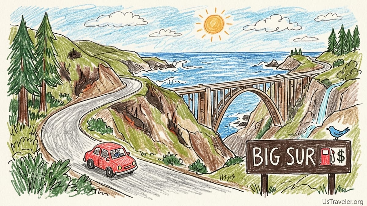
Driving Into Big Sur: The Route That Shaped My Trip
My most recent Big Sur trip started in Monterey on a clear September morning in 2026, just after Highway 1 had reopened following weeks of wildfire-related closures between Fernwood and south of Julia Pfeiffer Burns. Caltrans and local outlets had reported that both the Timber Fire near Pfeiffer Big Sur State Park and the Plaskett Fire farther south had forced multiweek closures earlier in August, and you could still see the burn scars on the hillsides above the road in a few places. Traffic moved cautiously, partly because of the curves, partly out of a shared awareness that this landscape had just been on fire. I topped off the gas tank in Monterey, where regular was posted in the mid 5 dollar range per gallon, because I knew the prices at small Big Sur stations would usually hover higher.
From Monterey, I followed Highway 1 through Pacific Grove and Carmel-by-the-Sea, then south past Point Lobos and into Garrapata State Park. Cell service faded almost exactly where the road began hugging the cliffs in earnest. I use a major carrier and, outside small pockets near Big Sur Village, my phone was an expensive camera and not much else. This mattered later when closures and parking restrictions forced last-minute changes. If you are used to relying on maps apps for every turn, download offline directions before leaving Carmel or Monterey.
My rough plan was an out-and-back day trip from Monterey to McWay Falls and back, with time at Garrapata State Park, Bixby Creek Bridge, Point Sur, Pfeiffer Beach, Pfeiffer Big Sur State Park, Partington Cove and several roadside viewpoints. On the map this stretch of Highway 1 looks short. In reality, the curves, limited passing zones, and frequent photo stops stretch everything out. Without any major delays, the drive from Monterey to McWay Falls took me just over two hours heading south, and closer to three hours heading back as sunset traffic built and fog rolled in.
Heading into the trip I imagined a leisurely coastal cruise, but Big Sur demanded more attention and patience than that. The constant turns, variable light under the fog line, and pockets of road work made it feel at times more like navigating a mountain pass than a beach drive. By the time I reached the heart of Big Sur I had already revised my mental itinerary twice.
Garrapata State Park and the First Clifftop Walks
Garrapata State Park was my first real stop. The trailheads are unassuming gravel pullouts along the east side of Highway 1, just south of Soberanes Point. I pulled into one of the coastal trail parking areas that could hold perhaps a dozen cars, and by midmorning on a late September weekday it was already half full. There are no entrance booths and no restrooms directly at these small lots, only simple trail posts. I should have used facilities back in Carmel, a small but telling planning misstep that became a theme for the day.
From the car, the walk out to the bluff-top loop took about five minutes along a sandy, slightly uneven path lined with coastal scrub and ice plant. Fog was still streaming in low and fast, so the ocean moved in and out of view like someone slowly drawing aside a curtain. Photography at Garrapata was tricky but rewarding under these conditions. One minute the cliffs were flat and grey; the next, a beam of sunlight would punch through, illuminating a single sea stack or a patch of turquoise water. I eventually set the camera aside and just took in the sound of waves smashing into the rocks below.
What I liked most about Garrapata was how quickly you felt removed from the highway. Even though my car was less than a quarter-mile behind me, the coastal trail felt wild and exposed. Compared with some of the famous postcard overlooks farther south, Garrapata offered more room to spread out along the bluff, fewer people jockeying for one exact angle, and a better sense of the larger coastline. I ended up spending close to 45 minutes wandering short spurs to the edge, far more than the 15 minutes I had casually penciled in.
This was also where I got my first taste of how wildfire seasons and erosion shape Big Sur. Some interior trails at Garrapata are frequently closed due to past fire damage and restoration work, and signs at the trailhead made that clear. Although my focus this time was on the coastal side of the park, it reminded me that planning backcountry hikes here requires checking official park updates regularly, not just relying on older guidebooks.
Bixby Creek Bridge: Expectations, Parking Bans and the Reality on the Ground
By the time I rolled up to Bixby Creek Bridge, fog had lifted just enough to reveal the full sweep of concrete arches and turquoise cove below. Like many visitors, I had seen this bridge in car commercials and social media feeds for years. Even so, its setting surprised me. The structure itself is beautiful, but what really lands is the way the road clings to the headlands on either side and the depth of the canyon it crosses. The vertical drop to the small sandy beach far below makes you instinctively hold your breath when you pull alongside it.
In the past, the norm here was a chaotic assortment of cars nose-in on dirt shoulders, often double-parked, with people running across the highway for a shot. That scene has fundamentally changed. Following safety concerns, Monterey County approved a 12-month no-parking zone around Bixby Bridge that took effect in early August 2026, covering both sides of Highway 1 and the entrance to Old Coast Road. County fact sheets and tourism board alerts now explicitly state that shoulder parking is prohibited around the bridge while long-term solutions are studied. When I arrived, the new no-parking signs were frequent and clear, and the familiar rows of stopped cars were gone.
Practically, this meant I could not simply pull over at the classic north-side turnout and hop out for a picture. CHP and county enforcement vehicles were present on my visit, and they were actively moving along anyone who slowed excessively or attempted to stop where the ban was posted. I ended up continuing south past the bridge, turning around at a safe spot farther down the highway, then pulling into a legal turnout more than a half-mile away that still offered a distant view down the coast but not the iconic angle of the bridge itself. It was a little disappointing from a photography standpoint, but it felt much safer, and it respected the fact that emergency access and resident safety now take priority here.
Did Bixby Bridge live up to years of hype? In terms of raw beauty, yes. The canyon, the way the bridge frame cuts the sky, the colors of the water below all lived up to expectations. But between the parking moratorium, the narrowness of the highway, and the need to keep traffic flowing, the experience is now brief and drive-through. You appreciate the bridge as you move, not as a place to linger. Looking back, I prefer the slower, more immersive time I spent at Garrapata’s bluffs and later at Partington Cove. If you have limited time and are debating where to build in true stopping time, treat Bixby as a scenic drive-by and save your long stops for places designed to handle parked cars and wandering visitors.
Point Sur, Roadside Turnouts and the Quiet Pullouts I Loved More
South of Bixby, Highway 1 continues stacking cliff after cliff against the ocean, with Point Sur’s volcanic dome gradually rising on the horizon. I did not join one of the scheduled lighthouse tours on this trip, although the small lot at the access road showed a handful of cars and a posted schedule when I passed around midday. Instead, I pulled into a smaller paved viewpoint north of the point where only four or five vehicles could comfortably fit. From there, the view stretched across kelp beds to the black silhouette of Point Sur itself, and I could hear, faintly, the sound of waves on the long beach to the north.
This turnout became one of my favorite surprises. There was no iconic landmark demanding a specific shot, just a spacious view with plenty of room for everyone to stand at the rail without elbowing for space. I spent about 20 minutes here, watching low clouds thicken offshore and drift landward in slow motion. A couple in a campervan made lunch in their tiny kitchenette, another traveler read a paperback in the front seat, and it felt more like a rest stop shared among equals than a tourist “must-see.”
Throughout the day I grew more attached to these modest pullouts than to the headline locations. Their parking situations were simpler, often just a short paved area directly off the highway with enough room to fully pull out of traffic. Walking distances were minimal, usually only a few steps from car to railing. Photography was more relaxed too. Without expectations of recreating a famous image, I was free to notice smaller details like the patterns of foam in a particular cove or the way sun caught the spray below a barely visible waterfall.
The trade-off, of course, is that stopping at several of these along the way eats into time for longer hikes. Between Garrapata, a Point Sur overlook, and a couple of unnamed roadside turnouts, I burned nearly two hours in what had been a tightly packed schedule. If I were doing it again as a one-day trip, I would consciously cap the number of unscheduled pullouts and pick one or two favorite vistas to savor, rather than reacting to every promising curve in the road.
Pfeiffer Beach and Pfeiffer Big Sur State Park After the Fires
By early afternoon I turned off Highway 1 at the inconspicuous, unsigned narrow road that leads down to Pfeiffer Beach. This side road is managed by the Forest Service, and it feels like a private driveway at first, dropping steeply through trees with a posted low speed limit. I paid the day-use fee in cash at the booth near the bottom and squeezed into one of the last remaining spaces in the main lot, which on that day held roughly 60 or so vehicles tightly arranged. Late arrivals were already circling, waiting for someone to pull out. From my space, it was a three- to five-minute sandy walk to reach the wide beach, passing basic restrooms and picnic tables.
The beach itself was bright and wind-scoured when I arrived. The famous keyhole rock just offshore framed windows of crashing waves, though the angle of the sun was still high and harsh. I stayed about an hour, wandering down the sand and scrambling a bit on the rocks at the northern end, watching kids dodge cold waves. Smoke from the recent Timber Fire was not visible from the beach that day, but whispery reminders of fire were everywhere in conversation. Several people I spoke with mentioned trips canceled in August when Highway 1 and Pfeiffer Big Sur State Park closed completely.
Later that afternoon I drove a very short distance south to the entrance of Pfeiffer Big Sur State Park, which had only just reopened to the public on October 16 after serving as a base for Timber Fire operations. State Parks announcements described the reopening as partial, with the campground, Big Sur Lodge facilities, the River Path, Nature Trail, Buzzard’s Roost Trail and the Redwood Grove Boardwalk available again. Longer routes, including Pfeiffer Falls, Valley View, Oak Grove and many of the backcountry trails, remained closed under ongoing fire and erosion safety orders. On the ground, this translated to a park that felt usable but constrained, with clear “Trail Closed” signs blocking off familiar routes.
I parked in the main day-use lot near Big Sur Lodge, where spaces were filling fast by midafternoon. The fee station accepted cards and cash. From my car, it was an easy five-minute walk under redwoods along the River Path, which delivered the cooling experience I had been craving after the exposed cliffs. Light filtered down in dusty columns onto the Big Sur River, still running but noticeably low this late in the dry season. I spent about 40 minutes wandering short loops, reading interpretive signs about the park’s fire history, and chatting with a ranger who explained that reopening had focused on low-risk, short-distance trails while crews assessed damage and repaired infrastructure on more remote routes.
The partial reopening was bittersweet. On one hand, I was grateful simply to be under redwoods at all, knowing that flames had burned through portions of the park only weeks before. On the other hand, my original plan to hike up to Pfeiffer Falls had to be scrapped. This was one of several moments where the cumulative impact of 2026’s wildfires reshaped my expectations in real time. It also reinforced the need to treat all advance planning in Big Sur as conditional, especially if your visit falls in late summer or early fall.
Partington Cove, McWay Falls and Changing Access
Continuing south, the road narrowed and the terrain grew even more dramatic. I pulled over at Partington Cove in the late afternoon, locating the small dirt turnout on the ocean side that can easily be missed if you are driving too fast. Only a handful of cars were parked there, squeezed along the shoulder. A sign across the road marked the trailhead. The walk down to the cove is steeper than it appears from the highway, dropping nearly all the way to sea level along a fire road before ducking into a tunnel carved through the headland.
From car to water’s edge took me about 20 minutes walking at a moderate pace, with pauses to let uphill hikers pass on the narrower sections. The descent felt easy, but I was very aware that the return would be a slow grind back up. At the bottom, the cove was a pocket of unexpected calm, with dark boulders, kelp swirling in green water, and the muffled boom of waves echoing off the cliffs. Photography here benefited from the later hour: shadows added depth to the rock faces, and I could slow the shutter a little to blur the movement of the water without blowing out highlights.
My final major stop was McWay Falls in Julia Pfeiffer Burns State Park, a place I had visited on a previous trip years earlier, when the short Overlook Trail was fully open and offered textbook views of the waterfall dropping onto the small beach. McWay Falls is an 80-foot ribbon of water flowing year-round from McWay Creek over the edge of the cliff into the cove below. Historically, people could walk a short, mostly flat trail from the parking area, cross under the highway, and stand at a fenced overlook platform to take in the scene.
That historical experience is not the reality today. In 2025, State Parks closed the Overlook Trail for a long-term retaining wall repair project, and updates have indicated that the work would extend into 2026. On my visit, significant portions of the usual viewing path remained blocked, and access inside the small roadside parking areas was limited. Rangers and posted signs both reiterated a rule that has been in place for years: access to the beach below McWay Falls is strictly prohibited, to protect both visitors and the fragile environment. There is no legal way down to the sand, and trying to scramble there is dangerous and subject to citation.
I eventually found a legal pullout slightly north of the main park entrance, where a short roadside walk of a couple of minutes offered an angled view of the falls through gaps in the trees. It was not the picture-perfect postcard composition, but it was enough to appreciate how the falls still carve a pale streak against the tawny cliff. I spent only about 15 minutes here, aware that daylight was slipping and that the long drive back to Monterey still lay ahead. The experience underscored a theme of this trip: famous places are currently in flux. Infrastructure repairs, fire recovery and safety regulations are all reshaping how, and sometimes whether, you can experience them firsthand.
The Less Glamorous Realities: Fuel, Food, Traffic and Connectivity
It is easy to talk about Big Sur in nothing but superlatives, but my day also included a list of practical headaches that are worth noting. Fuel was the first. Even after topping off in Monterey, I watched the gauge more closely than I expected. There are fuel options in the Big Sur area, including at small stations near Big Sur Village, but prices tend to be significantly higher than in Monterey or Salinas. I saw posted regular prices roughly a dollar or more above what I had paid that morning. For a single day trip this is an annoyance rather than a crisis, but if you are on a longer coastal drive it can add up quickly.
Food was the second reality check. I had assumed that I could casually stop at any of the widely known restaurants and grab a quick meal. In practice, limited seating, seasonal hours, and lingering wildfire effects meant long waits or unexpected closures. At one roadside cafe near Big Sur Village, a hand-lettered sign on the door explained that staffing shortages and recent closures had forced them to limit hours. I ended up relying on snacks I had thrown into my bag at the last minute and a late sandwich from a lodge cafe that was swamped with other travelers who had the same idea.
Traffic delays were intermittent but real. Even with Highway 1 officially reopened, crews were still working at a few burn-adjacent stretches, with one-way traffic controls in place. At one location not far north of Pfeiffer Big Sur State Park, I idled for almost 15 minutes in a line of cars waiting for a pilot car to escort us through a narrow section. This might not sound like much, but on a day trip it eats into the margin you have for a sunset visit or an unplanned hike. Combined with the naturally slower pace dictated by the twists and turns of the road, it made my return to Monterey feel significantly longer than the southbound journey.
The lack of mobile data compounded small issues. Without reliable service, it became difficult to check real-time conditions or alternative dining options on the fly. I had printed a basic list of mile markers and park names before leaving, which turned out to be one of my smartest moves. When a ranger mentioned that certain trails remained closed or that a particular turnout was full, I could roughly recalibrate distances and timing using that sheet rather than guessing blindly.
The Stops That Stayed With Me and What I Would Do Differently
Looking back a few weeks later, my favorite stops were not always the ones I had circled in red on the map. Garrapata’s coastal bluffs, with their shifting fog and solitude just a few minutes from the car, delivered a sense of space and raw coastline that no single bridge shot could match. Partington Cove, reached after that steady downhill walk and tunnel passage, felt quietly intimate and worth every step of the climb back up. The small, unnamed turnout north of Point Sur offered a view broad enough to exhale in, with no pressure to take a perfect photograph.
Among the headline attractions, Pfeiffer Beach probably gave me the best balance of infrastructure and scenery on this trip. The paid parking lot, restrooms and short walk made it logistically straightforward, while the keyhole rock and broad stretch of sand more than justified the extra drive in from Highway 1. Pfeiffer Big Sur State Park, even partially open, provided a needed change of pace from cliffs and wind, and it is a place I would prioritize again, especially as more trails gradually reopen after the Timber Fire.
My biggest planning mistakes were all variations on underestimating constraints. I underestimated how much the 2026 wildfires and subsequent closures would shrink my options, from the shuttered Pfeiffer Falls Trail to lingering work zones on the highway. I underestimated how exhausting it can be to drive a full round-trip from Monterey to McWay Falls and back in a single day, with so many curves and concentration-heavy segments. And I underestimated how much time small delays would accumulate: waiting at temporary traffic controls, inching through busy parking lots, or rerouting when a turnout I had targeted was no longer accessible under new regulations.
If I were advising someone planning a similar trip now, I would suggest treating Big Sur less as a checklist and more as a corridor where you select a few anchor stops and allow ample breathing room. Build in at least 25 to 30 percent extra time on top of your driving estimates, assume that some trails will still be closed due to ongoing fire recovery or infrastructure work, and accept that regulations like the Bixby Bridge parking moratorium are part of traveling responsibly here in 2026 and beyond.
A Realistic One- or Two-Day Big Sur Plan Based on What Actually Worked
Based on this recent experience, a realistic one-day plan from Monterey or Carmel would focus on fewer, deeper stops between Garrapata and Pfeiffer Big Sur State Park, with McWay Falls treated as a bonus if time, road conditions and access cooperate. Start with a full tank in Monterey early in the morning, then stop at one coastal turnout in Garrapata rather than several. Spend a solid 45 to 60 minutes there stretching your legs and easing into the landscape. Continue south, enjoying Bixby Creek Bridge as a slow, continuous view from behind the wheel without attempting to park where the 12-month no-parking zone is now in force.
Midday, aim for a longer break at Pfeiffer Beach. Be prepared with cash for day-use fees and expect the small access road to be tight and slow, especially when vehicles meet on the narrow sections. After an hour or more at the beach, head to Pfeiffer Big Sur State Park for redwood shade and short walks on the River Path, Nature Trail or Buzzard’s Roost if it fits your timing and fitness. Accept up front that marquee hikes like Pfeiffer Falls may still be off the table while post-fire repairs and safety assessments continue.
If you are set on seeing McWay Falls on a one-day itinerary, treat it as a flexible endpoint. Check the latest closures before leaving town, and know that the traditional Overlook Trail has been closed for long-term retaining wall work. You may have to settle for a partial, more distant view from a legal turnout and you must respect the ongoing prohibition on accessing the beach below the falls. On my trip, trying to push all the way to McWay meant driving back north in the dark fog, which I would avoid next time if possible.
A two-day version of this trip is where Big Sur really breathes. Day one could mirror the route above but end overnight at lodging or a campground near Big Sur Village, allowing you to drive less intensely and linger longer in Pfeiffer Big Sur State Park. Day two would push farther south to Partington Cove and Julia Pfeiffer Burns State Park, leaving more time for the steep walk down to the cove and a relaxed, if modified, visit to the McWay Falls area. With two days, you also have more flexibility to adjust around temporary closures or smoky conditions if late-season wildfires flare again. The key difference is psychological as much as logistical: with an extra night, Big Sur shifts from a race against the clock to a slow unfolding of cliffs, coves and evolving rules that you can actually absorb.
The Takeaway
Traveling through Big Sur in 2026 means holding two truths at once. The first is that the place remains almost shockingly beautiful, with cliffs that seem to fall directly into the Pacific, redwood groves that offer instant relief from sun and wind, and small coves where waves endlessly redraw the edge of California. The second is that climate impacts, wildfires, landslides and heavy visitation have made the logistics more fragile and more regulated than they might appear in any glossy photo.
My own road trip from Monterey to McWay Falls and back was shaped as much by recent fire closures, a 12-month parking moratorium at Bixby Bridge, and evolving trail access at Pfeiffer Big Sur State Park and Julia Pfeiffer Burns as it was by any bucket-list stop. What worked best were the places built to handle my presence: Garrapata’s simple coastal trails, Pfeiffer Beach’s structured parking and wide sands, the open day-use areas under the redwoods once the park partially reopened. What I would change next time is less about chasing more stops and more about respecting the pace and constraints of a landscape that is still recovering.
If you go soon, arrive with a full tank, printed notes, flexible expectations and an understanding that some beloved views are meant to be glimpsed from a moving car now rather than a crowded shoulder. Leave extra time on both ends of your day, especially if wildfires have recently impacted the region. And when you find a turnout, cove or stretch of riverbank that makes you exhale, stay a little longer. Big Sur rewards those who move slowly, pay attention and recognize that preserving this coast for the next trip matters just as much as capturing the perfect photograph today.
FAQ
Q1. Is it still legal to park along the road at Bixby Creek Bridge for photos?
As of August 2026, Monterey County has implemented a 12-month no-parking zone around Bixby Bridge, including highway shoulders and the entrance to Old Coast Road, so you should not stop or park there for photos.
Q2. Can I hike down to the beach below McWay Falls?
No, access to the beach below McWay Falls remains prohibited. Visitors are limited to designated viewing areas, and there is no legal trail to the sand due to safety and environmental protection rules.
Q3. Is the classic McWay Falls Overlook Trail open right now?
On my recent visit, the Overlook Trail was still affected by a long-term retaining wall repair project, with portions of the usual viewing path closed. Travelers should check the latest California State Parks updates before expecting full access.
Q4. Which trails at Pfeiffer Big Sur State Park are open after the Timber Fire?
When the park reopened on October 16, 2026, short routes like the River Path, Nature Trail, Buzzard’s Roost Trail and the Redwood Grove Boardwalk were open, while longer trails such as Pfeiffer Falls, Valley View, Oak Grove and many backcountry routes remained closed.
Q5. How bad is mobile phone service along Highway 1 in Big Sur?
Coverage is very limited once you leave Carmel and drive south. I had only small pockets of signal near Big Sur Village and almost none at most trailheads and viewpoints, so offline maps and printed notes were essential.
Q6. Do I really need a full tank of gas before entering Big Sur?
It is strongly recommended. Fuel is available in the Big Sur area but at noticeably higher prices than in Monterey or Salinas, and long detours due to landslides or fires can quickly eat into your expected range.
Q7. Is a one-day Big Sur trip from Monterey enough to see everything?
One day is enough for a taste of the coast, a couple of shorter walks and a visit to Pfeiffer Beach or Pfeiffer Big Sur State Park, but it will feel rushed if you try to include every major stop down to McWay Falls.
Q8. How have recent wildfires changed the Big Sur experience?
The 2026 wildfires led to temporary Highway 1 closures, partial park shutdowns, ongoing trail repairs and visible burn scars. They have made conditions more variable and increased the importance of checking closure updates before and during a trip.
Q9. Are there still good views if some trails or overlooks are closed?
Yes. Even with certain trails closed, there are many legal roadside turnouts, coastal paths at Garrapata, views near Point Sur, and river walks at Pfeiffer Big Sur State Park that still offer outstanding scenery.
Q10. What is the biggest planning tip you would give first-time Big Sur visitors now?
Choose a few key stops instead of a long checklist, allow generous extra time for delays and closures, and stay flexible so you can adapt to fire impacts, parking restrictions and changing trail access without feeling like your trip is ruined.