


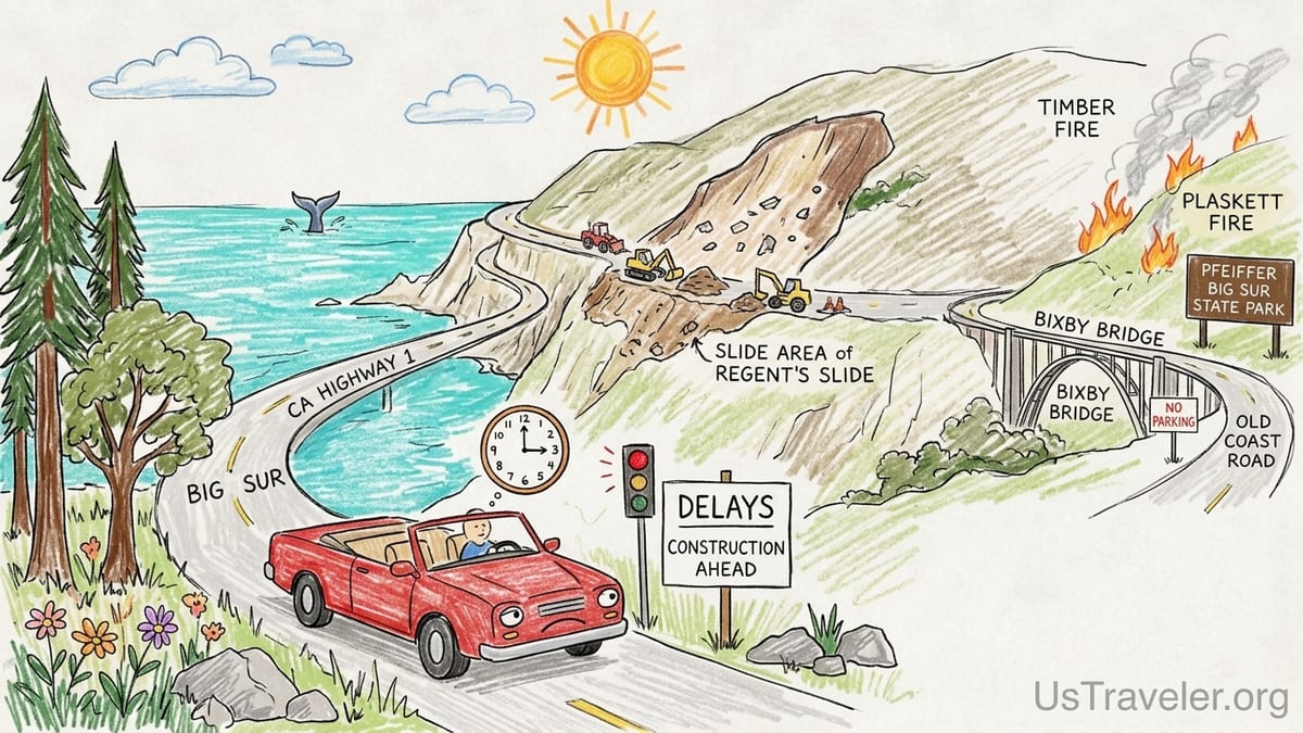
I lost almost an entire day of my life at Regent’s Slide. At 7:30 a.m. on a clear June morning in 2026, I pulled onto Highway 1 south of Big Sur feeling triumphant. After years of landslides and detours, the fabled coastal route was finally open again. I had a meticulously timed itinerary promising coffee in Carmel, McWay Falls by mid-morning, lunch in Gorda and sunset in Cambria. Instead, I spent five and a half hours trapped in a snaking line of cars near a construction signal, watching my fuel gauge drop and my carefully prepaid reservations evaporate.
How One “Perfect” Big Sur Day Went Expensively Wrong
The choke point that ruined my day was the freshly repaired section at Regent’s Slide, a slope failure that originally closed Highway 1 in February 2024 and only fully reopened on January 14, 2026 after years of stop‑start work. Celebratory headlines called it the end of Big Sur’s “historic closure” and destination marketing campaigns quickly snapped back to glossy images of carefree convertibles hugging turquoise cliffs. On paper, the road was open. On the ground that day, it was anything but carefree.
Ahead of me, a red signal held both directions in place so crews could clear mud that had slumped overnight. Behind me, rental SUVs idled, their drivers stepping out to photograph the very scar on the hillside that was quietly wrecking their itineraries. I watched the minutes on my dashboard clock outpace the miles. By the time I rolled through the one‑way control, my timed entry for a whale‑watching cruise out of Monterey was long gone and my nonrefundable inn reservation in Cambria was within cancellation penalty.
When I added up the cost later, it stung. The missed cruise was about 120 dollars. The “no‑show” fee from my Cambria inn was roughly half the room rate, around 180 dollars. Fuel burned in slow traffic, last‑minute dinner in Big Sur at resort prices, and the sunk cost of a full day rearranged at the side of a cliff turned what should have been a scenic drive into a case study in how fragile Big Sur plans really are in 2026.
That day at Regent’s Slide snapped me out of the fantasy that Big Sur is a simple coastal road trip that you can schedule down to the quarter hour. After months of following official updates, fire maps and park notices, I would go further. In 2026, a fixed Highway 1 itinerary is not just naive; it is a liability.
Regent’s Slide: Reopened, But Never Really “Solved”
On January 14, 2026, the California governor stood in front of cameras to announce the reopening of Highway 1 at Regent’s Slide. It was framed as a triumph. This one section of road had severed through travel between Monterey County and San Luis Obispo County since February 9, 2024, when a huge mass of hillside let go and buried the pavement all the way down to the ocean. Reopening nearly three months ahead of the projected March 2026 date was understandably celebrated as the end of an era.
What did not make the headlines to the same degree is the fine print: the slope that failed at Regent’s Slide did not magically transform into bedrock in January 2026. Caltrans documents describe an incredibly steep, complex hillside where repairs required constant adjustments. Even in the lead‑up to reopening, crews were still removing thousands of cubic yards of debris after winter storms. Engineers stabilized the slope, but they did not defy gravity or climate.
To see how precarious things remain, you only need to look at current road information. As of October 27, 2026, Caltrans lists multiple locations in Monterey County with one‑way controlled traffic on Highway 1, including daytime controls at Mud Creek for emergency work. The Transportation Agency for Monterey County’s cone zone report for the same week notes one‑way traffic controls at several stretches of Highway 1 for construction and slide repairs, turning what looks like a free‑flowing coastal highway on a map into a stop‑and‑go obstacle course.
This is the fundamental misunderstanding at the heart of so many Big Sur itineraries. Reopening does not mean stability. A segment can be technically open while still being held together by ongoing construction, periodic debris clearance and traffic controls that can swallow hours. Travelers planning a string of tightly timed stops along Highway 1 often discover this the hard way, as I did at Regent’s Slide.
October 2026: Controlled Traffic, Unpredictable Delays
On the morning I checked conditions for this piece, Caltrans’ official road information listed Highway 1 in Monterey County as open to through traffic but dotted with cautions. One‑way controlled traffic near Mud Creek, with work hours that cut into the heart of the driving day. Additional construction zones elsewhere along the coast with flagged traffic on weekdays. None of these were full closures, yet any of them could turn a seemingly reasonable 90‑mile drive into an all‑day commitment.
The nuance matters because a lot of travel content treats Highway 1 as if it were an interstate. It is not. In late October 2026, you can theoretically drive without detour from Carmel to Cambria. In practice, you may find yourself idling behind a pilot car, inching past temporary barriers, or waiting fifteen minutes at a time for oncoming traffic to clear a one‑lane stretch. When several controls line up on the same day, they multiply into serious delays.
During my most recent run between Carmel and Ragged Point, I left at 8:00 a.m. with an unambitious plan for a mid‑afternoon arrival. I still hit two separate one‑way controls south of Big Sur and spent roughly forty minutes cumulatively waiting. On a road with no shortcuts or parallel routes, those forty minutes cannot be clawed back. They pushed my planned lunch into mid‑afternoon and compressed my daylight buffer for the final, most winding section of the drive.
Multiply that by high season traffic, tour buses, and drivers unused to tight cliffside curves, and the romantic notion of “popping down from San Francisco for a half‑day Big Sur outing” in 2026 quickly falls apart. Highway 1 currently works for travelers who respect its fragility and budget for its unpredictability. It punishes those who schedule it like a suburban bypass.
Fire Season Reality: Timber and Plaskett Fires Reshape the Map
Road instability is only half the story in 2026. The other half is fire. The Timber Fire, which burned through parts of Pfeiffer Big Sur State Park earlier in the year, turned the region’s most popular inland redwood park into a fire camp and ash‑coated work zone for months. California State Parks announced that the park would reopen on October 16, 2026, but with major caveats. Trails such as Pfeiffer Falls and Valley View remain closed while crews assess damage and remove hazards. Oak Grove, Mount Manuel and other routes are still listed under fire closure notices rather than welcome banners.
South of there, the Plaskett Fire on the south coast disrupted access near Plaskett Creek and surrounding Los Padres National Forest land. Even after flames are out, agencies are cautious about reopening steep, fire‑scarred slopes above narrow mountain roads and campgrounds. Travelers scrolling Instagram for “Plaskett Creek sunset” posts may have no idea the landscape is still in recovery, that campgrounds might be closed or reserved for firefighters, or that a new rainstorm could trigger slides on freshly burned hillsides.
What complicates trip planning is that highway status and park status often diverge. In August and September, Highway 1 could be open past certain mileposts while state parks immediately off the road were closed because they were inside fire perimeters or being used as operational bases. By mid‑October, Pfeiffer Big Sur State Park’s day‑use areas and a portion of its campground were cleared to welcome visitors again, even as some signature trails remained off limits. The region is a patchwork of open, partially open and closed areas, and that mosaic shifts throughout the year.
If your itinerary assumes that a reopened road automatically means open trailheads, campgrounds and viewpoints, you are building on sand. One of my own missteps was booking a campsite months ahead at a Big Sur state park that later closed for fire operations while the reservation system still showed availability. The park ultimately cancelled those bookings, but not everyone got the message in time. Social media is full of stories of travelers arriving to find locked gates at parks they thought were confirmed.
McWay Falls, Bixby Bridge and the Myth of Effortless Stops
Nowhere is the gap between online advice and on‑the‑ground reality in 2026 more glaring than at McWay Falls and Bixby Bridge. For years, articles and blog posts have promised that you can simply “pull over for photos” at both. That language is now badly out of date.
McWay Falls, inside Julia Pfeiffer Burns State Park, has long been a source of confusion. You cannot hike down to the beach, and the classic viewpoint is reached via a short but sometimes congested trail from a small parking lot on the inland side of Highway 1. After recent fires and rockfall, portions of the overlook area and adjacent trails have been intermittently closed or narrowed. Rangers I spoke with described having to meter visitor flow on busy days to keep the walkway safe. What used to be a spontaneous five‑minute stop can now mean circling for a legal parking spot, waiting at the pay station if self‑service machines are out of order and queuing behind tour groups shuffling along a narrow path.
Bixby Bridge has changed even more dramatically. In June and early August 2026, Monterey County officials moved to address chaotic roadside parking near the bridge, which had created dangerous crowding, litter and safety hazards. By late summer, a 12‑month no‑parking restriction was in effect near Bixby Bridge, including stretches of Old Coast Road that had become unofficial overflow parking. You can still drive across the bridge. You cannot, for the time being, park your car along Highway 1 to stage those iconic arch‑over‑the‑canyon photos from the shoulder.
Travel itineraries and videos that breezily suggest you will “stop at Bixby for 20 minutes” have simply not caught up. On my last pass, I watched cars slow abruptly, confused by new signage and enforcement, then reluctantly roll on without stopping. Some pulled into narrow dirt pullouts far from the bridge and tried to walk back along the highway, a risky move that sheriff’s deputies and rangers are actively discouraging.
The result is a mismatch between expectation and reality. Travelers arrive with a mental checklist of “must‑have shots” and discover that some of those stops are now illegal, unsafe or require far more time and planning than a neat itinerary suggests. The resentment that follows is often directed at “California” or “the authorities,” when the real issue is outdated planning advice.
Slow Roads, Sparse Services and the Cost of Rigidity
Even without landslides, fires or new parking bans, Highway 1 through Big Sur is not a fast or easy road. It is narrow, cliff‑hugging and relentlessly curvy. On long stretches there are no shoulders and only a handful of safe turnouts. Speed limits drop to 35 or 25 miles per hour in some spots. Locals in older pickups, delivery vans and RVs stack up long lines of cars behind them, and passing opportunities are infrequent.
On my last drive from Carmel to Cambria, a distance of about 90 miles, I averaged well under 30 miles per hour once photo stops, construction controls and slow traffic were factored in. Fuel options are limited. Prices at small stations near Big Sur and Gorda are noticeably higher than in Monterey or Paso Robles. I paid roughly one‑third more per gallon at a station south of Big Sur than I had that morning inland. Mobile coverage from major carriers drops out for long segments of the drive, especially between Big Sur Village and Ragged Point. Navigation apps freeze, road alert pages time out, and even voice calls cut off mid‑sentence.
Accommodation adds another layer of risk. In Big Sur proper, lodging tends to be either rustic campsites or very high‑end hotels and lodges. Standard rates of 600 to 1,500 dollars per night at well‑known properties are common in busy periods, and many of these stays are sold on stricter cancellation terms than budget options in town. Deposit and refund policies vary, but it is not unusual to see partial or fully nonrefundable bookings within a week of arrival, especially for weekends.
Contrast that with nearby bases in Monterey, Carmel‑by‑the‑Sea or Cambria, where a wide range of chain hotels, motels and vacation rentals offer more flexible cancellation, sometimes up to 24 or 48 hours before arrival. I once held a nonrefundable one‑night Big Sur cabin reservation that I ended up forfeiting because Highway 1 closed south of Monterey after a rockslide the day before my trip. Friends who had booked in Monterey instead managed to pivot inland, spending an extra day exploring Carmel Valley wineries rather than eating the entire cost of a night’s stay they could not reach.
In a region where a single overnight slide or new fire perimeter can close the highway or key parks without warning, tying hundreds or thousands of dollars to immovable Big Sur lodging is a serious financial gamble. The brochures will not tell you that. Local tourism sites understandably focus on the positive. It is up to travelers to weigh that risk honestly.
Why “See Every Viewpoint in One Afternoon” Is a Dangerous Fantasy
Spend a few minutes searching “Big Sur day trip” and you will find plenty of sample itineraries that promise the impossible. They lay out schedules where you depart San Francisco mid‑morning, stop at Bixby Bridge, hike at Point Lobos, picnic at Pfeiffer Beach, stroll among redwoods at Pfeiffer Big Sur State Park, visit McWay Falls, detour to Limekiln’s waterfalls and still roll into Cambria for dinner. All of this is supposed to fit into a single leisurely afternoon on Highway 1.
Having attempted a softer version of that checklist years ago and knowing the 2026 conditions intimately, I can say bluntly that these itineraries are irresponsible. They ignore construction controls, parking bottlenecks, fire closures and the basic physics of winding mountain roads. They assume every parking lot has space, every trail is open, every restroom line is short and every driver in front of you is going the speed limit. They also assume no one in your car wants to stop spontaneously at an unplanned turnout just because the light on the ocean looks perfect.
On a recent weekend, I watched a family from Europe pull into a crowded turnout near Julia Pfeiffer Burns State Park, visibly agitated. They had a paper itinerary that listed “McWay Falls: 15 minutes” and “Pfeiffer Beach: 45 minutes” separated by a 20‑minute drive time. In reality, the McWay parking lot was full, rangers were temporarily pausing new entries, and traffic crawled toward Pfeiffer Beach Road, which itself can back up when the small beach lot reaches capacity. Their schedule was blown before lunch, yet all their dinner plans and lodging reservations were anchored to that unrealistic timeline.
What these rigid plans miss is the essence of coastal travel in a time of climate‑driven instability. Landslides and fires are not flukes in Big Sur; they are regular features. In 2026, the question is not whether delays will happen, but how you will handle them. A good itinerary flexes. A bad one breaks and takes your mood and budget down with it.
Checking Reality: Caltrans QuickMap and State Parks Alerts
Reliable, up‑to‑date information exists. The problem is that many travelers never use it. Instead, they rely on old blog posts, guidebooks printed years ago or word of mouth. Before any Big Sur trip in 2026, two official sources should be non‑negotiable: Caltrans’ QuickMap for roads and California State Parks alerts for parks.
QuickMap is Caltrans’ statewide traffic conditions platform. It shows real‑time information about Highway 1, including full closures, one‑way controls, incident reports and chain requirements in winter. When I checked it while writing this, QuickMap confirmed the one‑way control at Mud Creek listed in the highway information report and pinpointed several other construction zones with icons along the Big Sur coast. It also indicated active work hours, which is crucial for deciding whether an early‑morning or late‑afternoon departure is more strategic.
California State Parks, meanwhile, maintains alert pages for individual parks such as Pfeiffer Big Sur State Park, Julia Pfeiffer Burns, Limekiln and Andrew Molera. These pages outline current closures, fire damage, trail statuses and any temporary day‑use or campground shutdowns. In early October 2026, for instance, Pfeiffer Big Sur’s page shifted from a blanket closure due to the Timber Fire to a partial reopening announcement that clearly listed which trails and facilities remained off limits. Without checking that page, it would be easy to arrive expecting a network of open redwood hikes and instead find barricades and “trail closed” signs.
The key is timing. Conditions on Highway 1 can change in a matter of days, especially during winter storms or peak fire season. Checking QuickMap and park alerts a month before your trip is not enough. You should be checking them again in the week before, the day before, and on the morning you depart. Screenshots and offline notes help when cell service drops, which it often does between Big Sur Village and Ragged Point. Treat these tools as essential as your fuel gauge, not as optional extras.
From Costly Errors to a More Resilient Big Sur Plan
Looking back at my own mistakes, a pattern emerges. I booked nonrefundable lodging in Big Sur before confirming long‑term roadwork schedules. I strung too many sights onto single days, assuming smooth traffic and easy parking. I trusted dated advice that framed Bixby Bridge pullouts and McWay Falls access as simple add‑ons. I skimmed official alerts instead of reading the full details and checking for updates right before departure.
If I were planning a Big Sur trip in late 2026 for someone I cared about, I would start with a very different philosophy. First, I would anchor lodging in more flexible hubs such as Monterey, Carmel or Cambria, especially during the peak of landslide and fire seasons. From Monterey or Carmel, you can still enjoy day trips south into Big Sur and retreat inland if Highway 1 closes suddenly. From Cambria, you can explore north to Ragged Point and beyond when conditions allow, with easier detours to Paso Robles or inland US 101 if they do not.
Second, I would build an itinerary around fewer, deeper stops instead of a checklist. One solid coastal hike, one redwood walk if parks are open, one or two viewpoints that are realistically accessible given current parking and restrictions. I would allocate generous buffers between each, assuming that at least one construction control, minor rockfall cleanup or congestion spike will slow me down every day. Rather than insisting on Bixby Bridge photos this year, I might focus on legally accessible overlooks further south where stopping is still allowed.
Third, I would always map an inland bailout. US 101 through Salinas, Paso Robles and San Luis Obispo is not as glamorous as Highway 1, but it is a vital alternative. On one recent trip, a late‑breaking advisory about overnight rockfall risk near Lucia convinced me to abandon a coastal Cambria arrival and instead cut inland from Monterey to Salinas and down 101, adding miles but preserving safety and simplicity. The next morning, I approached Big Sur from the south after checking QuickMap again. That kind of flexibility is the difference between an adventure and an ordeal.
Finally, I would treat Highway 1 itself as the main attraction rather than a conduit between Instagram moments. If wildfire conditions close Pfeiffer Big Sur’s trails, I can still appreciate the cliffs and sea stacks from legally accessible turnouts. If McWay Falls is jammed, I can enjoy less famous coves and pullouts without forcing a stop that strains the system. By lowering the number of non‑negotiable “musts” in a given day, I gain the ability to adapt when the coast reminds me who is really in charge.
FAQ
Q1. Is Highway 1 through Big Sur fully open in late October 2026?
As of October 27, 2026, Highway 1 is open to through traffic between Monterey County and San Luis Obispo County, but several sections have one‑way controlled traffic for construction and slide repairs. Travelers should expect delays and verify current conditions on Caltrans’ QuickMap and highway information line before driving.
Q2. Can I stop and park near Bixby Bridge for photos in 2026?
No. Monterey County has implemented a 12‑month no‑parking restriction near Bixby Bridge, including parts of Old Coast Road, due to safety and crowding concerns. You may drive across the bridge but should not plan on pulling over nearby for photos this year.
Q3. Is Pfeiffer Big Sur State Park open after the Timber Fire?
California State Parks has announced that Pfeiffer Big Sur State Park reopens to the public in mid‑October 2026 following the Timber Fire, but with ongoing trail closures. Popular routes such as Pfeiffer Falls and Valley View remain closed while crews address fire damage, so visitors should review the park’s latest alerts before planning specific hikes.
Q4. Can I visit McWay Falls right now?
Access to the McWay Falls overlook at Julia Pfeiffer Burns State Park has generally been available, but parking is limited and parts of the overlook area or nearby trails may be narrowed or temporarily closed due to erosion and maintenance. Expect congestion, follow ranger instructions on the ground and do not assume you can simply pull over for a quick, guaranteed viewpoint stop.
Q5. How bad is cell service along Highway 1 in Big Sur?
Mobile coverage along Highway 1 between Carmel and Ragged Point is patchy at best, with long stretches of little or no signal for many major carriers. Travelers should not rely on constant data access for maps or alerts and are wise to download directions offline and check road and park conditions before leaving areas with strong service.
Q6. Should I book lodging in Big Sur or stay in Monterey, Carmel or Cambria?
Staying in Big Sur can be magical but often involves higher prices and stricter cancellation policies. More flexible options in Monterey, Carmel or Cambria usually offer better cancellation terms and give you the ability to pivot inland via US 101 if Highway 1 closes on short notice, reducing the financial risk of weather‑ or fire‑related disruptions.
Q7. How many Big Sur stops are realistic in one day?
Under current conditions, planning for just a few major stops in a day is more realistic than trying to see every viewpoint. For most travelers, two or three significant stops, such as one coastal hike, a redwood walk if open and a scenic turnout or two, is a manageable plan when you factor in winding roads, traffic controls and limited parking.
Q8. What is the safest way to plan around landslides and fires?
The safest approach is to check Caltrans’ QuickMap for road closures and one‑way controls, review California State Parks alerts for individual park status, build generous time buffers into each driving day and keep an inland alternative route via US 101 in mind. Avoid rigid schedules and be prepared to change plans if conditions shift.
Q9. Are nonrefundable Big Sur bookings a good idea in 2026?
Given the history of sudden landslides, fire closures and traffic controls on Highway 1, fully nonrefundable Big Sur bookings carry significant risk. Travelers who prioritize flexibility often prefer accommodations with moderate or flexible cancellation policies in nearby towns so they can reroute without losing the entire cost of a night’s stay.
Q10. Is a Highway 1 Big Sur road trip still worth it with all these challenges?
Yes, if you plan with eyes open. The cliffs, redwoods and coves of Big Sur remain extraordinary, but in 2026 they reward travelers who respect the road’s fragility, check official information often and build itineraries that can bend rather than break when landslides, roadworks or fires intervene.