


Driving California’s Highway 1 between San Francisco and Los Angeles is one of the world’s classic coastal road trips. Even with periodic closures around Big Sur, it remains a spectacular journey of cliffside viewpoints, small beach towns, and Pacific sunsets. This guide focuses on planning a practical, closure-aware route between San Francisco, Monterey, Carmel, Big Sur, San Luis Obispo, Santa Barbara and Los Angeles, with concrete advice on rental cars, overnight stops, hotels and key viewpoints.
Know Before You Go: Closures, Seasons and Direction
Highway 1 is stunning but fragile. As of August 2026, a section in Big Sur is closed around Slates Hot Springs due to wildfire impacts and earlier slide damage. That means you currently cannot drive the full Big Sur coastline in one continuous stretch, but you can still experience the northern Big Sur section from Carmel and the southern Big Sur coastline from San Luis Obispo County by backtracking. Before you commit to dates, cross-check conditions with official California road reports and local visitor bureaus, since closures can change with new storms or slides.
For a mostly coastal experience from San Francisco to Los Angeles in current conditions, many travelers drive south from San Francisco to Monterey and Carmel, explore the accessible northern Big Sur segment as a day trip, then cut inland via Highway 68 and US 101 toward San Luis Obispo. From there, you can dip back to the coast around Morro Bay, Pismo Beach and Santa Barbara before continuing along the ocean into greater Los Angeles. If the full Big Sur section reopens in time for your trip, you can simply remain on Highway 1 between Carmel and San Simeon instead of routing inland.
Driving southbound is generally more comfortable for first-timers because the ocean will be on your right-hand side, making it easier to pull into viewpoints. Plan for modest daily distances. While San Francisco to Los Angeles can be driven in a very long day on interior freeways, the scenic route is best treated as a three to five day journey. This allows time for detours to wineries near Paso Robles, long lunches in Carmel or Santa Barbara, and a relaxed arrival in Los Angeles rather than a late-night crawl on the freeway.
Weather on the central coast can be deceptive. Summer often brings fog, especially around San Francisco, Monterey and Big Sur, while late September and October are typically clearer with warm afternoons and cool nights. Winter storms are what usually trigger slides and closures, but they also bring dramatic surf. Pack layers, a waterproof shell, and be prepared for windy bluff-top viewpoints even on sunny days.
Starting in San Francisco: Rental Cars and the First Coastal Stretch
Most travelers begin this trip by picking up a rental car in San Francisco. At San Francisco International Airport you will find the major national brands such as Enterprise, Hertz, Avis and Budget clustered at the rental car center. For a one-way rental that you will drop in Los Angeles, expect to pay a noticeable premium: a compact car in shoulder season might run around 65 to 100 dollars per day before taxes and insurance for a three to five day rental, while a midsize SUV can easily be 100 to 160 dollars per day. When you compare options, look closely at the one-way drop fee, which can add a few hundred dollars to the total.
Choose a vehicle that balances comfort and size. The tight curves around Big Sur and the crowded streets of San Francisco and Santa Monica feel easier in a smaller car, but you may appreciate the higher seating position and extra luggage room of an SUV. Convertibles are popular for the romantic idea of driving with the top down along the Pacific, but in practice the coastal wind and fog mean you may only use the open top for part of the day. Whatever the vehicle, request automatic transmission unless you are very familiar with manual driving on steep, winding roads.
Leaving San Francisco, many drivers head south across the city and join Highway 1 near the coastal districts. A typical first day might be San Francisco to Monterey or Carmel, which is about two and a half to three hours of pure driving time but can easily stretch into six to eight hours with stops. You can pause in Pacifica for a coffee with ocean views, then continue to Half Moon Bay to walk the bluffs above the beach or grab lunch in the small downtown. Farther south, consider a stop at Pigeon Point Lighthouse or the surf town of Santa Cruz, where you can stroll the beach boardwalk or grab fish tacos downtown.
Overnight, Monterey and Carmel offer a wide range of accommodation. In Monterey, larger midrange hotels such as the Portola Hotel & Spa near the historic harbor or chain properties around Munras Avenue often price in the 180 to 280 dollar range on weeknights outside peak holidays, with higher rates in summer and during major events. Couples seeking a small, walkable base often like Carmel-by-the-Sea, where boutique inns such as La Playa Carmel or Hotel Carmel typically run anywhere from 280 to well over 500 dollars per night depending on season and room type.
Monterey, Carmel and Northern Big Sur: Viewpoints and Classic Stays
Plan to spend at least a full day and night in the Monterey and Carmel area if your schedule allows. Monterey’s Cannery Row, the Old Fisherman’s Wharf and the world-class Monterey Bay Aquarium can fill an entire day, especially for families. Tickets for the aquarium are a significant line item in your budget, but many visitors consider the exhibits, including the giant kelp forest and open sea tanks, a highlight of the trip. Monterey also offers whale watching tours that head into the submarine canyon offshore, where sightings of humpback whales are common in season.
Carmel-by-the-Sea contrasts with Monterey’s busy waterfront. Its village streets are lined with galleries, small courtyards and low-rise inns, and Carmel Beach at the end of Ocean Avenue offers a wide sandy cove for sunsets. Many travelers choose Carmel as the base for their Big Sur day trip because it is slightly closer to the northern Big Sur viewpoints. Boutique properties such as Cypress Inn, La Playa Carmel and smaller cottage-style inns cluster within walking distance of restaurants, bakeries and wine tasting rooms, allowing you to park the car and explore on foot in the evening.
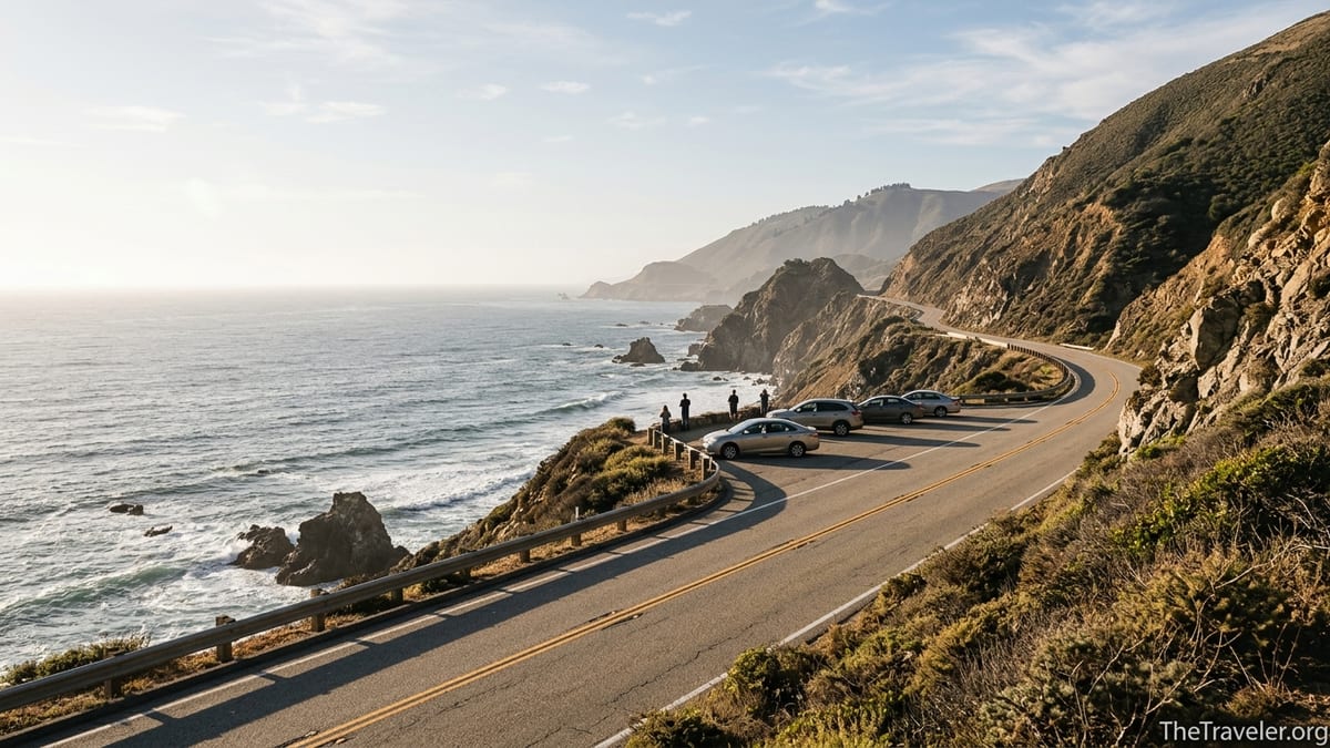
From Carmel, drive south into northern Big Sur for a half or full day. Even when the central Big Sur section is closed, you can typically reach famous viewpoints like Bixby Creek Bridge and Hurricane Point from the north, as well as state parks such as Garrapata or Point Lobos (technically just north of Carmel) when conditions allow. Parking at popular pullouts is limited, especially in the late morning and at midday, so aim to leave Carmel early. Early morning fog can wrap the headlands in mist, but it often burns off by late morning to reveal sheer cliffs and turquoise coves.
If you want to splurge on an overnight inside Big Sur rather than basing in Carmel, you will find a handful of storied properties. Post Ranch Inn and Alila Ventana Big Sur sit high on the cliffs with ocean views, extensive spa facilities and fine dining, with rates that commonly range from roughly 1,500 dollars per night upward for standard rooms, especially on weekends. More modestly priced options like Big Sur Lodge, Glen Oaks Big Sur or cabin-style stays at Big Sur River Inn and Fernwood Resort offer a simpler forest setting, with many rooms in the 300 to 600 dollar range depending on season.
Routing Around Central Big Sur: Toward San Luis Obispo
With the central Big Sur segment closed, you currently cannot continue all the way through to Ragged Point and San Simeon on Highway 1. Instead, most travelers backtrack from their southernmost accessible viewpoint in northern Big Sur to Carmel, then connect to Highway 68 and US 101 toward the Central Coast. Although you will miss a portion of the most famous coastal cliffs, the inland route opens up wine country detours and rolling farmland that many Highway 1 itineraries skip.
One practical plan is to spend one or two nights in the Monterey and Carmel area, devote a day to northern Big Sur viewpoints, then on your departure morning drive back through Monterey and take Highway 68 east toward Salinas and US 101. From there, you can head south through the Salinas Valley toward Paso Robles and San Luis Obispo. The drive from Carmel to San Luis Obispo via this inland route usually takes about three and a half to four and a half hours without long stops, but it is worth adding time for lunch or wine tasting in Paso Robles if you enjoy vineyards.
San Luis Obispo and the nearby coastal towns along Highway 1 make logical overnight stops between Monterey and Santa Barbara. Many travelers choose San Luis Obispo itself for its lively downtown, Thursday evening farmers market and wide choice of hotels. A character property like the Madonna Inn, famous for its individually themed rooms and roadside neon presence, often prices in the 250 to 450 dollar range, while national chain hotels closer to the freeway can be more modest. If you prefer to stay right on the water, smaller coastal communities like Morro Bay, Cayucos, Cambria or Pismo Beach feature oceanfront motels and inns where basic rooms might start around 150 to 250 dollars outside peak summer weekends.
From San Luis Obispo, you can still sample the southern Big Sur coastline by driving north on Highway 1 to Cambria, San Simeon and Ragged Point, then backtracking. This out-and-back excursion turns the closed section into a day trip rather than a through route. Along the way, you can visit the elephant seal colony near Piedras Blancas, tour Hearst Castle perched in the hills above San Simeon when tours operate, and stop for coffee or a short coastal walk at a cliffside property like Ragged Point Inn. Allow at least half a day for this excursion, more if you plan to take a Hearst Castle tour.
Santa Barbara to Los Angeles: Classic Coastal Finale
Continuing south from San Luis Obispo, Highway 1 and US 101 overlap and separate several times before narrowing to a coastal route again near Santa Barbara County. Many itineraries choose Santa Barbara as the final overnight before entering the Los Angeles metropolitan area. The city blends Spanish-style architecture, a sheltered beach, an active harbor and a walkable downtown State Street lined with shops and cafes. If you time your arrival for mid-afternoon, you can check into your hotel, walk the waterfront in the golden late-day light and find dinner at a restaurant along the Funk Zone or near the pier.
Santa Barbara offers accommodations at nearly every price point. Upscale properties near the water, such as Hotel Californian or the Ritz-Carlton Bacara on the coastal bluffs west of town, frequently see nightly rates in the 500 to 900 dollar range in peak season. Closer to downtown, midrange chain hotels and smaller inns often run in the 220 to 350 dollar range on typical nights. For a more local feel, look for smaller Spanish-style motels along Bath Street and Castillo Street within walking distance of the beach, where you can sometimes find simpler rooms nearer 180 to 250 dollars when demand is lower.
The final drive into Los Angeles can be as relaxed or as rushed as you like, depending on how often you stop. If you stay on the coastal variants of Highway 1 south of Santa Barbara, you will pass Carpinteria, Ventura and Oxnard before reaching Malibu. On a weekday morning without major traffic incidents, Santa Barbara to central Los Angeles might take just under two and a half hours, but weekend afternoons and rush hour can add significant time. Consider pausing in Malibu for lunch at a beachfront cafe or to walk the sand near Malibu Lagoon or Zuma Beach, then continue into Santa Monica to end your Highway 1 journey with a stroll on the pier or along the Pacific Palisades bluff-top path.
Within greater Los Angeles, you will eventually transition from the coastal highway to city streets and freeways. If you plan to drop your rental car at Los Angeles International Airport, aim to return it before the late afternoon rush. Factor in time to refuel the car near the airport and navigate the multi-level roads around the rental car facilities. If you are staying in Los Angeles for several days, parking costs at city hotels can be substantial, so include nightly parking fees in your lodging budget when you compare rates.
Choosing Overnight Stops and Hotels for Different Travel Styles
For a three-night San Francisco to Los Angeles itinerary, a classic pattern is Monterey or Carmel on night one, San Luis Obispo or Cambria on night two, and Santa Barbara on night three. With four or five nights, you can add an inland wine country stop near Paso Robles or a night in Big Sur itself. Budget-focused travelers often prioritize Monterey over Carmel for the first stop, because average hotel prices in standard chain properties there can be 50 to 100 dollars lower per night than in the more boutique-heavy Carmel village, yet it is still only a short drive to Carmel Beach.
Couples on a special occasion trip might choose to allocate more of the budget to one memorable hotel rather than trying to upgrade every night. That could mean two solid midrange nights in Monterey and San Luis Obispo and then a splurge stay at a Big Sur property like Post Ranch Inn or Alila Ventana, or at a beachfront Santa Barbara or Malibu hotel on the final night. Families often prefer suites or rooms with kitchenettes in Monterey or Pismo Beach, where beach access and more casual restaurants make evenings easier with children, and may skip the ultra-high-end Big Sur retreats in favor of cabin-style resorts or simple motels.
When you compare hotels, look beyond nightly rates to parking fees, resort charges and breakfast. In dense areas like downtown Santa Barbara or central Los Angeles, parking can add 30 to 60 dollars per night at larger hotels. Many coastal inns along Highway 1 include free parking and continental breakfast, which can reduce your overall trip cost. If you travel in the quieter shoulder seasons of spring and fall, you may find that boutique inns are more willing to offer midweek promotions, while July, August and major holiday periods sell out early across the route.
Because Highway 1 is popular worldwide, reservations are important, especially for Big Sur, where the number of rooms is limited. Post Ranch Inn, Alila Ventana, Deetjen’s-style cabin inns, and even simpler campgrounds can book out months ahead for peak weekends. In contrast, cities like Monterey, San Luis Obispo and Santa Barbara usually keep some last-minute availability, though prices may be higher. A balanced strategy is to reserve the small or high-demand properties well in advance and leave one or two nights in bigger cities flexible if you enjoy improvising.
Practical Route Planning, Driving Tips and Viewpoints
Highway 1 involves significant two-lane driving, frequent curves and the absence of guardrails in some areas. If you are not used to mountain roads, remember that you control the pace. Use the designated turnouts to let faster traffic pass rather than hugging the cliff edge while you watch your mirrors. Defensive driving is especially important near popular viewpoints like Bixby Creek Bridge, where some drivers brake abruptly as they spot the view. Avoid distractions and ask a passenger to handle photography so the driver can focus on the road.
Fuel availability along Big Sur is limited and more expensive than in cities. A smart rhythm is to start each day with at least half a tank and to fill up in larger towns such as Monterey, Carmel, San Luis Obispo or Santa Barbara before heading onto long scenic stretches. Mobile data coverage also drops along the more remote sections, so downloading offline maps for California and key route segments is helpful. Paper maps from car rental desks or visitor centers provide a durable backup if your phone battery runs low or navigation apps struggle for signal.
Viewpoints and state parks are the true highlights of this road trip. Around Monterey and Carmel, consider Point Lobos State Natural Reserve for dramatic coastal trails, sheltered coves and potential sea otter sightings. In Big Sur, classic viewpoints include Bixby Creek Bridge, Hurricane Point and McWay Falls in Julia Pfeiffer Burns State Park when open. Farther south, near San Simeon, the elephant seal rookery, Moonstone Beach in Cambria and the bluffs around Ragged Point deliver a rugged, wave-battered coastline. Santa Barbara’s shoreline path and the bluffs at Douglas Family Preserve offer softer, palm-framed sunsets as you transition toward the urban south.
Weather can influence your daily plan. If marine fog blankets the coast on a given morning, you can focus that day on indoor or inland experiences such as the aquarium in Monterey or wine tasting near Paso Robles, then drive the most scenic segments later in the day when conditions tend to clear. In winter or during active storm systems, be ready to pivot if rockfall or flooding closes a short section of Highway 1 with little notice. Keeping one spare day in your itinerary gives you margin to wait out a temporary closure or to explore an inland alternative rather than feeling forced to push through risky conditions.
The Takeaway
A Highway 1 road trip between San Francisco and Los Angeles is still achievable and deeply rewarding in 2026, even with an active closure affecting central Big Sur. With flexible routing, you can enjoy the major coastal towns of Monterey, Carmel, San Luis Obispo and Santa Barbara and still experience signature Big Sur viewpoints on carefully planned day trips. The key is to treat the route as a series of short, scenic hops rather than a race, allowing time for slow lunches, side roads and sunset walks.
Thoughtful choices about rental cars, hotel styles and overnight stops can keep the trip aligned with your budget and travel personality. Whether you prioritize a once-in-a-lifetime night in a Big Sur cliffside retreat, a family-friendly motel steps from the sand, or a design-forward boutique hotel in Santa Barbara, there are concrete options for every style. By staying closure-aware, driving conservatively and reserving high-demand stays early, you can turn this classic California drive into a smooth, memorable journey down the Pacific coast.
FAQ
Q1. How many days do I need for a Highway 1 road trip between San Francisco and Los Angeles?
Most travelers allow three to five days for this route. Three nights gives you time for Monterey or Carmel, San Luis Obispo or Cambria, and Santa Barbara, while five or more nights lets you add Big Sur and wine country stops without rushing.
Q2. Is it still worth driving Highway 1 if the Big Sur section is partially closed?
Yes, it is still worthwhile. You can access northern Big Sur from Carmel and southern Big Sur coastline from San Luis Obispo County as separate day trips, while using inland highways for the through connection between Monterey and San Luis Obispo.
Q3. Which direction is better, driving northbound from Los Angeles or southbound from San Francisco?
Southbound from San Francisco to Los Angeles is generally easier for first-time visitors because the ocean is on the right, making viewpoints and turnouts simpler to access. It also naturally ends in the larger Los Angeles airport hub for one-way rental returns.
Q4. What type of rental car is best for the Highway 1 coastal drive?
A comfortable compact or midsize car with automatic transmission suits most travelers. Curvy Big Sur segments and tight city parking favor smaller vehicles, though some travelers like a midsize SUV for the higher seating position and extra luggage space.
Q5. When is the best time of year to drive Highway 1?
Late spring and early fall often provide the best mix of lighter crowds and clearer weather. Summer brings longer daylight and busy conditions, while winter offers dramatic surf but a higher risk of storms and slide-related closures.
Q6. Do I need to book all my hotels in advance?
It is strongly recommended to book Big Sur and other small coastal inns well in advance, especially for weekends and holidays. Larger cities like Monterey, San Luis Obispo and Santa Barbara usually have more last-minute availability, but prices can be higher on busy dates.
Q7. How should I handle fuel, food and rest stops on the more remote sections?
Fill your tank in larger towns such as Monterey, Carmel, San Luis Obispo or Santa Barbara before driving long scenic stretches. Remote stations exist but are usually more expensive. Plan food and restroom breaks around towns and state park parking areas where facilities are available.
Q8. Are there good options for budget travelers along Highway 1?
Yes. Budget travelers often base in Monterey instead of Carmel, choose inland or freeway-side motels near San Luis Obispo, and look for simpler beach motels in places like Pismo Beach or Morro Bay. Traveling in shoulder seasons also helps keep rates lower.
Q9. Can I do the Highway 1 coastal route using public transportation instead of a rental car?
Public transportation along the exact coastal route is limited and fragmented, especially through Big Sur. Some segments are served by regional buses, but for a flexible, continuous scenic trip between San Francisco and Los Angeles, a rental car is the most practical option.
Q10. What safety considerations should I keep in mind on Highway 1?
Drive at a comfortable pace, use turnouts to let faster vehicles pass, and avoid distractions on narrow, winding sections. Watch for rockfall after storms, respect closure signs, and carry water, snacks and a charged phone in case of unexpected delays or temporary closures.