


California is built for road trips. Snow capped Sierra peaks, Pacific cliffs, desert canyons and world class cities are all within a day’s drive of each other. This guide walks you through the most rewarding statewide routes, how to choose a rental car, what to expect for fuel and parking, and four realistic 7 , 10 , 14 and 21 day driving circuits that link iconic national parks with unforgettable coastal drives.
Choosing the Right California Road Trip Route
California stretches more than 770 miles from the Oregon border to Mexico, so your first decision is how big a bite to take. A classic first timer route connects San Francisco, Yosemite, Sequoia and Kings Canyon, Los Angeles and San Diego in a loop of roughly 1,200 to 1,400 miles, depending on detours. That distance fits comfortably into a 10 to 14 day itinerary if you prefer two to four hour driving days. Travelers with only a week often choose either a focused Northern California loop, such as San Francisco to Yosemite and back via Lake Tahoe, or a Southern California loop built around Los Angeles, Joshua Tree and San Diego.
The second decision is your emphasis. If dramatic coastal scenery is your priority, Highway 1 between San Francisco and Los Angeles is the star. In normal conditions, the uninterrupted coastal segment from Monterey through Big Sur to San Simeon can take five to six hours of wheel time even though the mileage looks modest, because the road is narrow and winding. If your focus is national parks, the east side of the Sierra Nevada along Highway 395 is ideal in late spring, summer and early fall, when Tioga Pass to Yosemite and other high mountain roads are usually snow free.
Weather and season matter. Winter months bring snow to the Sierra and occasional rain or mudslide closures along the Pacific Coast Highway, which can force long detours inland on Highway 101 or Interstate 5. Late May through October tends to offer the most route flexibility, with longer daylight hours and typically dry roads, though wildfires can affect air quality and road access in late summer and early fall. When you are sketching routes, build in a buffer day or two specifically to absorb an unexpected closure or smoky day so you are not forced into marathon drives.
Finally, think about entry and exit cities. Many international visitors fly into San Francisco and out of Los Angeles, or the reverse, to avoid backtracking; this “open jaw” pattern often adds a modest one way rental fee but saves 300 to 400 miles of duplicate driving. Others pair Las Vegas with California parks, for example driving from Las Vegas to Death Valley, Yosemite, Sequoia and then ending in San Francisco. Booking open jaw flights and a one way rental car early usually keeps costs reasonable, especially around peak summer holidays.
Rental Cars, Insurance and Practical Costs
Most major agencies operate from California’s gateway airports, including San Francisco, Los Angeles, San Diego, Oakland and Sacramento, as well as city locations around Union Square in San Francisco or West Hollywood in Los Angeles. Compact and midsize sedans generally offer the best balance of price and fuel efficiency for two to four people; expect base daily rates to vary widely by season, with summer and holiday weeks commonly double shoulder season prices. For example, it is common to find compact cars around 40 to 60 dollars per day in quieter months, but 70 to 120 dollars per day in July or around major events. Larger SUVs typically cost more but can be worthwhile for families or if you are carrying camping gear.
When comparing rentals, look at total trip cost rather than headline daily rates. California state and local taxes, airport surcharges, additional driver fees and one way drop charges can add substantially to the bill. Many agencies now quote “pay now” rates that are lower but less flexible, alongside standard “pay later” bookings that can usually be cancelled or changed closer to pickup. If you hold a credit card that offers primary rental car insurance, verify the coverage details and decline duplicate coverage at the counter if appropriate, but be sure your policy covers the full duration of your road trip and all named drivers. If not, purchasing the collision damage waiver from the rental company can remove financial risk, especially when driving mountain roads or parking in busy cities.
Fuel is a major trip expense. California gasoline prices are often among the highest in the United States and fluctuate seasonally. It is common to see significant differences between urban and remote stations, with stations near national park entrances or along isolated stretches of Highway 1 charging noticeably more per gallon. A realistic planning figure for a typical midsize car is to assume several hundred dollars in fuel costs for a two week loop of around 1,500 miles, more for larger SUVs. For savings and peace of mind, fill up in larger towns such as Salinas, Fresno, Bakersfield or Barstow before entering remote parks or high altitude highways.
Parking adds up quickly in cities. Overnight hotel parking in downtown San Francisco or central Los Angeles often runs 40 to 80 dollars per night for valet or garage spots, and some boutique hotels offer only paid valet. In contrast, motels near freeway exits or in suburbs such as Pasadena, Oakland or South San Francisco often include free parking, which can significantly lower your total road trip budget. Many visitors choose to stay slightly outside the most central neighborhoods, then use public transit or rideshares for one or two days of intensive city sightseeing before continuing their drive.
Driving Highway 1 and Other Classic California Roads
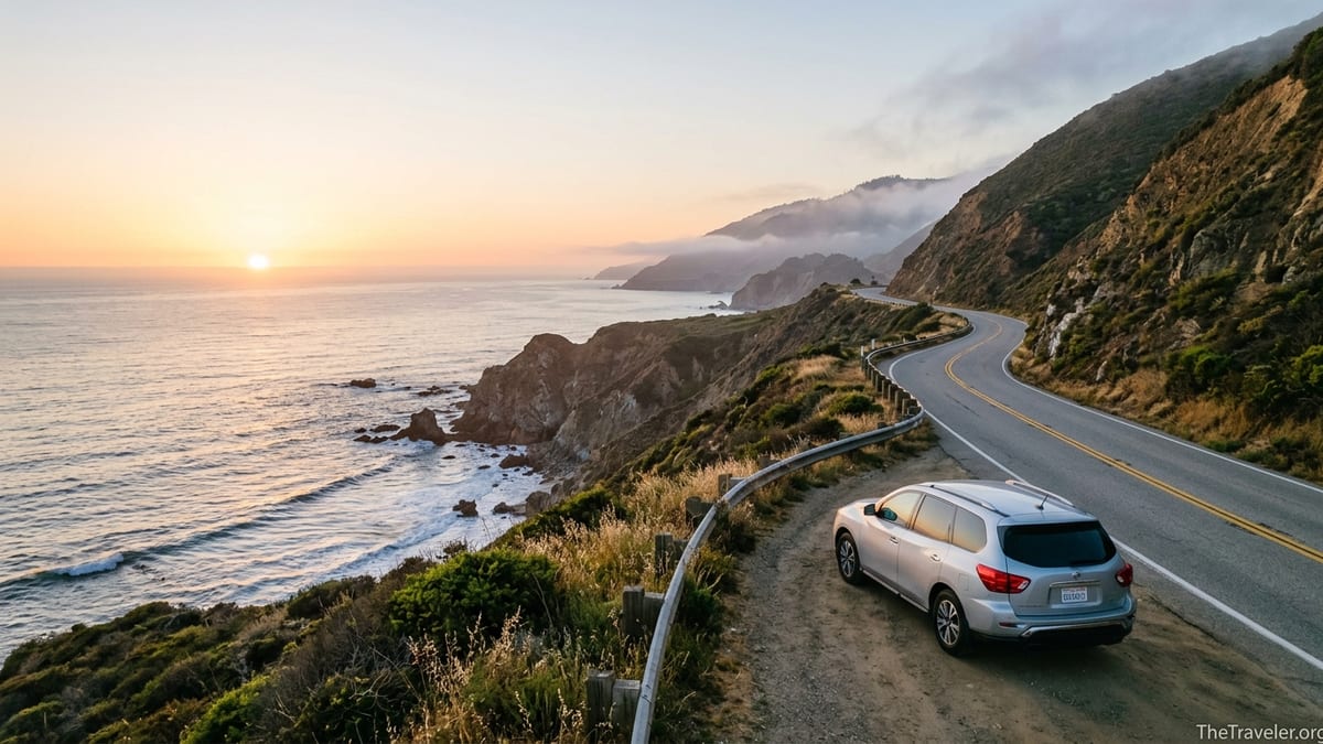
California State Route 1, commonly called the Pacific Coast Highway along certain stretches, runs along much of the state’s coastline and is one of America’s most celebrated scenic drives. The most photographed portion hugs the Big Sur cliffs between Carmel by the Sea and San Simeon, crossing landmarks such as Bixby Bridge and passing turnouts with sweeping ocean views. Because sections of this route have experienced landslides and washouts in recent years, it is important to check current conditions before committing; closures often mean taking Highway 101 inland between Monterey County and San Luis Obispo County instead.
Allow more time than your navigation app suggests on coastal routes. Traffic slows through small towns such as Santa Cruz, Monterey, Cambria and Morro Bay, and there are frequent scenic pullouts. Many travelers find that driving from San Francisco to Santa Barbara along the coast works best as a leisurely two or three day segment rather than a rushed single day drive, with overnight stops in Monterey or Pacific Grove and either Cambria, Pismo Beach or San Luis Obispo. If your schedule is tight, you can drive part of Highway 1 for its scenery and then cut inland to faster freeways like US 101 or Interstate 5.
Other iconic California drives deserve a place on your route. Tioga Road through Yosemite National Park, usually open from late spring through fall, climbs to more than 9,000 feet and links Yosemite Valley with Lee Vining and Highway 395 on the park’s east side. The Generals Highway connects the giant sequoia groves of Sequoia and Kings Canyon National Parks; its hairpin turns require slow speeds but reward you with close access to trees such as General Sherman. Farther south, the loop through Joshua Tree National Park between the West Entrance Station near the town of Joshua Tree and the Cottonwood Entrance near Interstate 10 showcases both boulder piles and wide open desert washes.
In cities, be prepared for dense freeways and local driving habits. Greater Los Angeles has multiple parallel freeways connecting similar destinations, and traffic congestion can turn even short hops into hour long efforts at peak times. Many visitors time their departures from Los Angeles or the Bay Area early in the morning or after dinner to avoid heavy rush hour patterns. Navigation apps are useful, but be cautious if they suggest very narrow residential streets as shortcuts; sticking to main arterials is usually less stressful if you are unfamiliar with the area.
National Parks: Yosemite, Sequoia, Joshua Tree and Beyond
California’s national parks are the anchor points of many road trips. Yosemite, Sequoia, Kings Canyon, Joshua Tree, Death Valley, Lassen Volcanic and Redwood all lie within realistic driving range when you plan a longer circuit. For Yosemite specifically, summer and early fall are the busiest periods, and in 2025 the park is using a peak hours vehicle reservation pilot on many days for daytime entry between late spring and early September. The precise dates and hours shift year to year, so always review current National Park Service information well before your trip and secure any necessary entrance reservations or lodging that may confer access.
Inside Yosemite and Sequoia, parking lots in Yosemite Valley and near the Giant Forest Museum can fill by mid morning on busy days. A common strategy is to arrive at or before sunrise, park once and explore by foot or on shuttle buses rather than moving your car throughout the day. Travelers staying in gateway communities such as Mariposa, Oakhurst, Three Rivers or Springville should budget 60 to 90 minutes to reach major trailheads, factoring in mountain curves and possible delays at entrance stations.
Desert parks are more forgiving for parking but require special care for heat and distance. In Joshua Tree, a loop entering near the town of Joshua Tree and exiting near the Cottonwood Visitor Center can involve relatively short drives between pullouts, but summer temperatures often climb extremely high. In Death Valley, distances between services are longer; for example, the drive from Furnace Creek to Badwater Basin and back is roughly 45 miles, while heading from Furnace Creek over Towne Pass toward Panamint Springs adds dozens more miles with significant climbs. Carry extra water in the car, avoid overworking the engine on steep grades in extreme heat, and plan fuel stops in advance since only a few stations operate inside or near the park boundaries.
Entrance fees are typically collected at park gates or via digital passes. A standard private vehicle pass for a single park is valid for multiple days, while the America the Beautiful annual pass can be cost effective if you will visit three or more national park units during a single trip. When planning your driving circuits, cluster parks geographically so you can take advantage of these multi day validity periods rather than hopping back and forth between distant regions.
Realistic 7, 10, 14 and 21 Day Road Trip Circuits
A 7 day California road trip works best when you keep the geography tight. One popular pattern is to fly into San Francisco, spend one night in the city without a car, then pick up a rental and drive to Yosemite for two or three nights, followed by a return via the Gold Country towns along Highway 49 or a stop at Lake Tahoe before heading back to the Bay Area. Another 7 day option is a Southern California loop: three nights based in Los Angeles with a side trip to Malibu or Santa Monica, one or two nights near Joshua Tree or Palm Springs, and the final nights in San Diego before flying out.
With 10 days, you can connect coast and mountains without too much rush. A classic north to south itinerary might look like this in driving terms: San Francisco to Monterey (about two hours), then a full day exploring Big Sur and staying in Cambria or San Simeon, followed by a shorter hop to Santa Barbara. From there, cut inland to Sequoia National Park via Bakersfield, then continue north to Yosemite before looping back to San Francisco. Each driving segment ranges from roughly two to five hours, giving you time for walks and viewpoints on most days.
Two week trips around 14 days allow for a near statewide loop. One practical version begins in San Francisco, heads to Yosemite and Sequoia, then swings south to Death Valley and Joshua Tree before finishing with coastal days in San Diego and Los Angeles and a final drive up Highway 1 or Highway 101 back to the Bay Area. Another 14 day option focuses on Northern California: San Francisco, Napa or Sonoma wine country, the Redwood National and State Parks area near Eureka and Crescent City, and then a return via Redding, Lassen Volcanic National Park and Lake Tahoe.
With 21 days, you can slow the pace and include rest days with no driving. A three week California road trip might start with four nights around San Francisco and the Marin Headlands, continue to Yosemite and Kings Canyon for five or six nights split between lodges and campgrounds, add three nights along the Central Coast in places like Pismo Beach and Morro Bay, then devote a full week to Southern California. That final week could include several nights in Los Angeles, a coastal interlude in Laguna Beach or Oceanside, and three or four nights in San Diego with a side trip to Anza Borrego Desert State Park if the wildflowers are blooming.
Driving Distances, Speeds and Safety Tips
Map apps can underestimate how tiring California driving can be, especially on mountain and coastal roads. A nominal 150 mile stretch of Highway 1 between Monterey and Cambria can take four to five hours without long stops, and similar distances in the Sierra can feel slow because of curves and elevation changes. Aim to keep most individual driving days under five hours of actual wheel time, leaving space for meals, photography stops and the inevitable construction zone or accident delay.
Recognize that average speeds vary by road type. Interstate 5 and long stretches of Highway 99 through the Central Valley are built for steady, higher speed travel, though enforcement of speed limits is active. In contrast, park roads, the Generals Highway, Tioga Road and smaller mountain passes frequently have limits of 25 to 45 miles per hour, and slowing for wildlife, hikers crossing and rough patches is common. Plan fewer miles on days that involve these slower segments so you are not forced to drive them in darkness when fatigue is higher and viewpoints are not visible.
Safety basics are especially important on long rural legs. Keep at least half a tank of fuel when heading into remote areas, carry several liters of drinking water per person and store some non perishable snacks in the car in case of unexpected delays. In summer, a lightweight reflective sunshade can help keep the interior cooler during trail stops, while in winter and spring, chains may occasionally be required on certain Sierra passes or within parks during snow events; rental car contracts vary on whether chains are permitted, so clarify this in advance and follow all posted requirements.
Finally, build in tech redundancy. While navigation apps provide good routing in cities, cell coverage drops in Big Sur, parts of Yosemite, Sequoia, Death Valley and the far north coast. Download offline maps for California regions before leaving strong signal areas and consider a printed atlas or park map as a backup. Many rental cars now include Apple CarPlay or Android Auto, which can mirror your phone’s apps, but they still rely on the same underlying network coverage, so do not let a single phone be your only navigational tool.
The Takeaway
A successful California road trip balances ambition with realism. Choosing routes that match your time frame, investing in a comfortable and economical rental car, and understanding the rhythms of coastal highways and national park access will keep long driving days from overwhelming the very landscapes you came to see. Build your plan around a few anchor destinations and then leave room for serendipitous stops whenever a roadside taco stand or bluff top turnout catches your eye.
Whether you have 7 days or a full 3 weeks, combining Highway 1 vistas with Sierra granite domes and desert sunsets is entirely achievable with thoughtful pacing. Check current park reservation rules and road conditions as your departure approaches, reserve key accommodations early in peak seasons, and keep a flexible attitude toward weather and traffic. If you treat the drive itself as part of the adventure rather than a blur between attractions, California’s roads will reward you at every turn.
FAQ
Q1. Do I really need a car for a California road trip, or can I rely on trains and buses?
For statewide itineraries that include national parks and coastal byways like Big Sur, having a car is highly recommended. Major cities such as San Francisco and Los Angeles have public transit, but connections between parks, small beach towns and desert areas are sparse. Trains and intercity buses work for point to point travel between big cities, yet they rarely reach trailheads or scenic pullouts without additional rideshares or tours.
Q2. What type of rental car is best for California’s mix of cities, mountains and coast?
A compact or midsize sedan suits most travelers because it is easier to park in cities and generally uses less fuel on long drives. Families or groups of four with lots of luggage may prefer a midsize SUV for the extra cargo space and higher driving position on mountain roads. Unless you are tackling unpaved backcountry routes, which are uncommon on classic itineraries, four wheel drive is usually not essential.
Q3. How far in advance should I book car rentals and park lodging for summer trips?
For peak summer months and school holidays, it is wise to book car rentals and key park lodges at least three to six months in advance. Yosemite valley accommodations often sell out as soon as booking windows open, and popular coastal towns like Carmel, Pismo Beach and Santa Barbara can be tight on weekends. Booking early usually yields better prices and more vehicle choice, especially for one way rentals.
Q4. Are one way road trips between San Francisco and Los Angeles worth the extra rental fee?
For many travelers, yes. Driving one way between San Francisco and Los Angeles or San Diego allows you to spend all of your time moving forward instead of backtracking several hundred miles. The added one way drop charge on the rental is often offset by saving a full day of driving and an extra tank or two of fuel. This format also makes it easier to include national parks on an inland return leg if you have more days.
Q5. How do I handle parking in big cities like San Francisco and Los Angeles?
In dense downtown areas, expect hotel garages or valet parking to carry nightly fees that can exceed 50 dollars. To manage costs, some travelers stay in neighborhoods with easier street or lot parking, such as parts of Oakland for San Francisco visits or Pasadena and Culver City for Los Angeles. Another strategy is to return the car while you are in the city center and rely on public transit and rideshares, then rent a new vehicle when you are ready to continue the road trip.
Q6. What should I know about Yosemite’s and other parks’ reservation systems?
In recent years, Yosemite has used timed or peak hours vehicle reservations on certain days in late spring and summer to manage congestion, while other parks have experimented with similar measures. The exact dates, hours and rules can change each year, so always check current National Park Service information before finalizing your plans. If reservations are in place, you may need to secure timed entries, wilderness permits or lodging bookings that double as access passes.
Q7. Is it safe to drive Highway 1 along Big Sur, and what about landslide closures?
Highway 1 along Big Sur is generally safe when open, but it is a narrow, winding cliffside road that demands attentive driving and slower speeds. Sections are sometimes closed for extended periods after landslides or storm damage, requiring detours inland via Highway 101. Before you go, confirm current road conditions using official California transportation updates so you can decide whether to take the coastal route or an inland alternative.
Q8. How many hours per day should I plan to drive on a longer California loop?
Most travelers find three to five hours of driving per day to be a comfortable upper limit, especially when routes include mountain passes or coastal segments. On a 14 or 21 day trip, you can mix shorter transfer days of one to two hours with a few longer days to bridge bigger gaps. Building in occasional no drive days in cities or parks helps prevent fatigue and gives you time to explore without watching the clock.
Q9. What is the best season for combining coastal drives with high Sierra national parks?
Late May through early October usually offers the best balance for seeing both Highway 1 and high elevation parks like Yosemite and Sequoia in a single trip. By early summer, snow has typically melted from major mountain roads, while coastal weather is often mild with occasional fog. Shoulder months such as June and September can bring thinner crowds and slightly lower prices than peak July and August.
Q10. How can I keep fuel and overall costs manageable on a California road trip?
Choosing a fuel efficient car, filling up in larger towns instead of remote stations and avoiding unnecessary backtracking are the easiest savings. Staying slightly outside city centers with high parking fees, cooking some meals in motels with kitchenettes or picnic areas, and traveling in shoulder seasons can also reduce expenses. If you plan to visit several national parks, consider an annual interagency pass to spread entrance costs across your entire circuit.