


I went into my Adirondacks road trip with one hard rule: I was not going to “do the whole park” in one heroic loop. The Adirondack Park is vast, and the fastest way to ruin it is to treat every day like a transfer day. Instead, I connected the lakes the way the region actually wants you to travel: by pairing nearby clusters, driving a few signature scenic byways slowly, and accepting that one or two moves between bases will simply consume time.
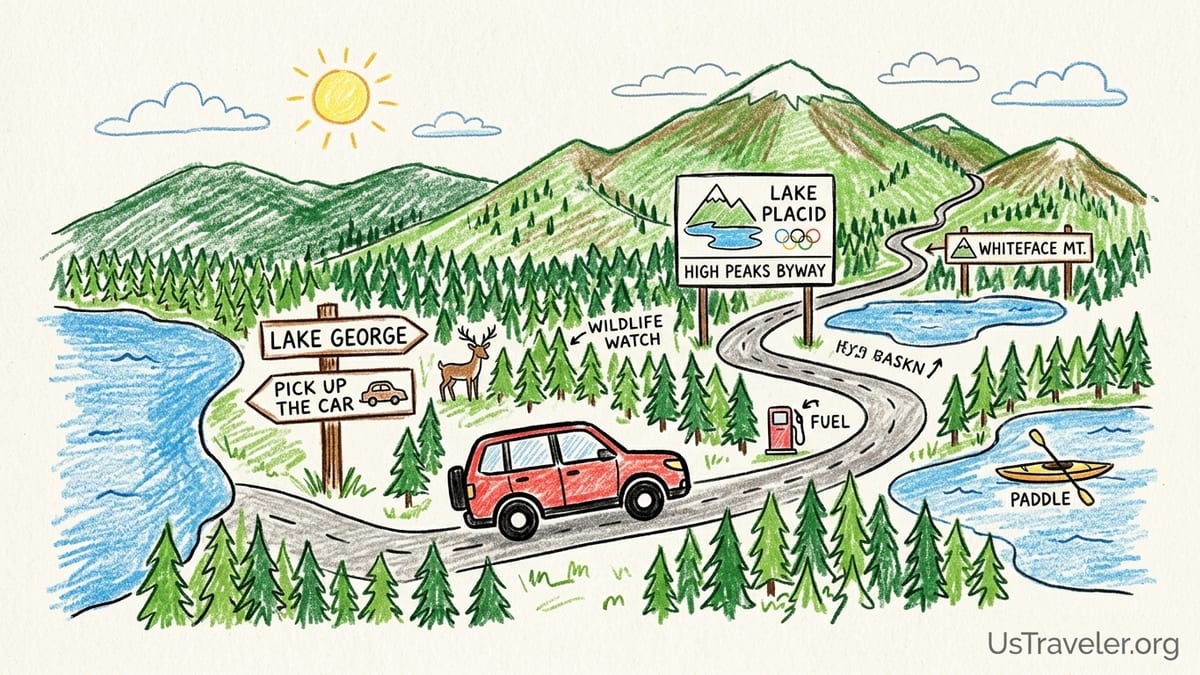
Picking Up The Car, Then Getting Out Of The Car (Quickly)
I started like many Adirondacks visitors do: by flying into the Albany area and picking up a rental car where inventory is deepest and prices are usually more reasonable than smaller regional airports. I chose an all-wheel-drive compact SUV because Adirondack shoulders can be narrow, rain is common, and I wanted decent ground clearance for the occasional gravel lot and rutted pullout. In late season, I also like having tires with a bit more tread than the typical sedan I would rent for a city weekend.
My first real-world lesson happened before I ever saw a mountain: timing the pickup matters. Leaving the rental facility late morning meant I hit peak traffic around the Capital Region and then settled into the rhythm of the Adirondack Northway. That was not stressful, but it was time I could have spent on the water. Next time I would pick up early, grab coffee and snacks right away, and aim to be past the suburban corridor before the day’s roadwork and weekend traffic have fully ramped up.
I also planned fuel around the geography, not the dashboard. Once you leave the bigger towns, gas stations are simply farther apart, and closing hours can be early in the smaller hamlets. My routine became: top off near a major Northway exit before heading deeper into the park, then top off again whenever I passed a station that was open and convenient. That habit saved me from the low-level anxiety of watching the needle drop while my phone showed one bar of service and no obvious alternatives.
Finally, I built my itinerary around Adirondack reality: you can spend your whole trip in the car if you string together far-apart highlights. So I chose bases where I could park once and then walk, paddle, or take short hops for two or three nights at a time. The theme of the trip was connection by clusters, not conquest by mileage.
Cluster One: Lake George As A Soft Landing (And A Smart First Night)
I used Lake George as a “soft landing” on the south end of the park because it is easy to reach from the Northway, it has plenty of lodging and dinner options, and it lets you ease into Adirondack driving before the roads tighten and the services thin out. The door-to-door time from the Albany area is short enough that you can arrive, check in, and still have daylight for a lakeside walk and an early dinner.
The drive itself is straightforward highway, and that is the point. Not every Adirondack day should involve two-lane mountain roads. Lake George is also a practical place to do the errands you do not want to think about later: picking up a cooler, stocking breakfast supplies, and confirming the next day’s plan while you still have strong cell service.
If you want a drive-up viewpoint right away, the Prospect Mountain Veterans Memorial Highway is an easy win. It operates seasonally, and for 2026 it is listed as open daily from May 23 through November 11, weather permitting. I treated it like a first-afternoon bonus: short drive, quick payoff, and a satisfying way to feel “in the Adirondacks” without turning the day into a marathon.
Parking in Lake George felt like classic resort logistics: lots of people, lots of turning in and out of lots, and plenty of pedestrians. I did not rush it. If you are coming from long highway mileage, a slower first afternoon is exactly what you want before you tackle the tighter, more scenic, more demanding Adirondack roads farther north.
Cluster Two: Lake George To Lake Placid And Whiteface (The Drive Worth Taking Slowly)
The next morning, I pointed the car toward the High Peaks region, aiming to make the drive itself part of the experience instead of something to “get through.” This is where Adirondack scenic driving becomes the product, not just transportation. Official Adirondack travel materials currently emphasize that the region is crossed by 14 New York State Scenic Byways, and two of the headliners for road trippers are the 30-mile High Peaks Byway and the 170-mile Olympic Trail. I did not try to do the Olympic Trail end-to-end. I used pieces of these routes when they made sense for the cluster I was actually traveling.
The High Peaks Byway, in particular, is built for exactly the kind of day I wanted. NYSDOT describes it as 30 miles connecting the Adirondack Northway at Exit 30 to Lake Placid, with marquee waters and pullouts along the way. In practice, I treated it as a string of short scenic stops rather than one continuous push. Every time the landscape opened up, I pulled off, took the photo, and then got back on the road before I started hunting for “one more viewpoint” that would keep me from arriving in Lake Placid with no time left to explore.
Road surfaces varied by segment: stretches of smooth pavement where you relax your shoulders, then sections where the lane narrows and the edge drops away. I found myself driving slower than the posted limit simply because it felt right. It also made wildlife sightings more manageable. I did not have a dramatic close call, but I stayed alert for deer at dusk, especially where tree lines meet wetlands. In the Adirondacks, “watch for wildlife” is not a slogan. It is a driving style.
Lake Placid was my base for this cluster because it is walkable once you park, and it gives you fast access to both village life and high-elevation weather. I also noticed quickly that parking rules matter here. The Lake Placid Police Department publishes parking information and restrictions, including lots with nightly no-parking windows and permit-only spaces. In practical terms, that meant I did not assume I could leave the car anywhere overnight, and I took a minute at check-in to ask exactly where my lodging expected me to park.
Whiteface Day: Mountain Weather, Lines, And Why The Toll Road Is Still Worth It
Whiteface Mountain is the one “high peak” where you can experience summit altitude without devoting the day to a long hike. That accessibility changes everything about the planning. It also changes the crowd pattern. On a clear day, Whiteface is not a secret, and you should expect lines at the toll house and slow traffic up the Veterans Memorial Highway, especially in mid-morning when most visitors arrive.
I planned Whiteface as an early start with a flexible ceiling. Mountain weather is moody in the Adirondacks. Down in town, it can feel like a mild summer day; up high, the wind can be sharp enough that you want a hat and a warm layer even in a month when you packed shorts. My rule was simple: bring a layer you do not think you need, and keep it in the car where it is easy to grab.
For operations, I relied on Whiteface’s posted schedule rather than assumptions. In the 2026 season information, the Whiteface Veterans Memorial Highway is listed as open daily in summer hours, with entry closing at 5:30 p.m. and a stated closing date of October 12, 2026. Those details influenced how I structured the day, because nothing is more frustrating than arriving late and learning the last entry window is earlier than you assumed.
Was it worth doing by car? Yes, with one caveat: treat the ascent like an activity, not a commute. I drove up slowly, used pullouts when safe, and accepted that the upper parking loop can feel like an airport pickup lane at peak times. If you expect a quiet summit, you will be disappointed. If you expect a rare chance to see Adirondack scale with minimal physical effort, it delivers.
Cluster Three: Lake Placid To Saranac Lake To Tupper Lake (Short Hops, Big Payoff)
After Lake Placid, I shifted into what I think is the most satisfying “lake-to-lake” cluster for travelers who want variety without constant packing: Lake Placid to Saranac Lake to Tupper Lake. These are short hops on the map, but they feel meaningfully different on the ground: different main streets, different waterfront access, different pace.
This is also where I stopped thinking of my car as the star. The car became a tool to connect trailheads, beaches, and meal stops. Door-to-door, these transfers are usually quick enough that you do not lose a full day, which is exactly why the cluster works. It is the antidote to the exhausting Adirondack mistake of driving two or three hours, arriving somewhere new, checking in, and then realizing you have no energy left to do anything.
In Saranac Lake, I paid closer attention to parking because village rules can change block by block and season by season. The Village of Saranac Lake publishes a downtown parking map, and even if you do not study it like a spreadsheet, it is useful for understanding where lots are and how the village expects visitors to circulate.
This cluster also introduced the Adirondack Rail Trail as an easy, car-light way to stitch communities together. Organizations involved with the trail have described it as a 34-mile route between Lake Placid, Saranac Lake, and Tupper Lake, open end to end. That matters for a road trip because it gives you a “reset button.” After a morning drive, you can park, walk or bike a segment, and feel like you traveled without logging another hour behind the wheel.
Central Adirondacks Without The Mega-Loop: Long Lake And Blue Mountain Lake As A Two-Night Base
To avoid building one enormous loop, I treated the central Adirondacks as its own trip within the trip. Instead of driving from Lake Placid to a far-flung corner and back in one day, I planned a base in the Route 30 corridor where the landscape opens into classic lake-and-forest scenes and where the roads feel like they were made for unhurried driving.
Route 30 is the spine here, and it pairs naturally with a cluster built around Long Lake and Blue Mountain Lake. The key is mindset: this is not the part of the Adirondacks to rush. Road surfaces can be good, but the driving is slower by nature, with long stretches of trees, fewer passing zones, and fewer services. Cell service can be unreliable, so I downloaded offline maps before leaving town and kept my expectations realistic about streaming music or relying on instant searches for “the nearest gas.”
Blue Mountain Lake gave me one of the most satisfying, low-stress “big attraction” afternoons of the trip: Adirondack Experience, the Museum on Blue Mountain Lake. I confirmed it was open for the 2026 season via its official materials before committing the drive. Museums are perfect on Adirondack days when the weather turns or your legs want a break, and this one fits the region rather than pulling you out of it.
Central Adirondack driving also sharpened my wildlife awareness. This is where “nothing on the road” can become “something on the road” quickly. I did not drive at high speed at night, and when I did drive near dusk, I stayed conservative on blind curves. The goal of this trip was connection, not a dramatic story.
Transfers That Ate The Day, And How I Would Fix Them Next Time
Not every drive was a winner. One transfer day, I underestimated how much time disappears into the mechanics of moving bases: checking out, loading the car, stopping for gas, grabbing food, getting slowed by seasonal roadwork, and then checking in and unloading. On paper, the drive time looked reasonable. In practice, door-to-door it felt like the day got swallowed whole.
My fix for next time is simple: treat long transfers as their own kind of day, with one planned stop that justifies the movement. That stop could be a short lakeside walk, a museum, or a viewpoint that is genuinely on the way. Without that anchor, a transfer becomes a blur of asphalt and snack wrappers.
I also learned to check live lane-closure information when approaching major corridors. In late September 2026, the New York State Thruway Authority’s scheduled lane-closures page listed work zones for that week on I-87, and NYSDOT announced ongoing pavement renewal work on the Adirondack Northway during the 2026 construction season. Even when you are not driving on the Thruway mainline, these projects influence traffic patterns and travel time around the broader region.
If your trip falls in shoulder season, double-check seasonal roads and summit access. Drive-up highways like Prospect Mountain’s and Whiteface’s publish operating windows and weather caveats for a reason. I planned around posted dates, built in slack, and still watched the sky. The Adirondacks do not reward rigid scheduling. They reward adaptable pacing.
The Takeaway
The Adirondacks clicked for me when I stopped trying to “see it all” and started linking lakes in clusters: Lake George as a soft landing, Lake Placid and Whiteface as the high-drama mountain hub, Saranac Lake to Tupper Lake as the easy-going connector, and a central Route 30 base for Long Lake and Blue Mountain Lake when I wanted the slow, classic Adirondack feel.
The best drive to take slowly was the High Peaks Byway segment into Lake Placid, because the scenery arrives in concentrated bursts and the pullouts feel like part of the experience. The drive most likely to consume a day was any longer base-to-base transfer where I failed to plan a meaningful stop. Door-to-door time is what matters here, not the number your map app shows for pure mileage.
If you want a road trip that feels like the Adirondacks instead of a commute across them, plan for fewer bases, earlier starts, more fuel discipline, and a healthy respect for patchy cell service and fast-changing mountain weather. Scenic driving is a major part of the region’s travel product for a reason. When you do it in realistic clusters, it stops being time in the car and starts being time inside the landscape.
FAQ
Q1. How many days do I need to connect Adirondack lakes without rushing?
For a relaxed trip that still covers multiple clusters, plan on at least five to seven days so you can stay two nights in each base area instead of transferring daily.
Q2. What is the single most scenic “short” drive that still feels like the Adirondacks?
The High Peaks Byway segment between the Adirondack Northway area and Lake Placid is only about 30 miles and is designed for scenic pullouts and mountain views.
Q3. When is Whiteface’s drive-up highway open in 2026?
Whiteface’s published 2026 information lists a seasonal closing date of October 12, 2026, with summer operations and daily access during the peak season, weather permitting.
Q4. When is the Prospect Mountain drive in Lake George open in 2026?
Local Lake George tourism information lists the Prospect Mountain Veterans Memorial Highway as open daily from May 23 through November 11, 2026, weather permitting.
Q5. Is cell service reliable between Lake Placid, Saranac Lake, and Tupper Lake?
It is reliable in the villages, but you should expect dead zones on backroads and in forested stretches. Download offline maps before leaving town.
Q6. Is the Adirondack Rail Trail open end-to-end?
Organizations supporting the trail have described the Adirondack Rail Trail as open from end to end between Lake Placid, Saranac Lake, and Tupper Lake, which makes it an easy add-on to a road trip.
Q7. What wildlife should I watch for on Adirondack roads?
Deer are the most common roadside hazard, especially around dawn and dusk. Drive conservatively on blind curves and avoid speeding at night on two-lane roads.
Q8. Where do road trips go wrong in the Adirondacks?
The classic mistake is building a mega-loop with too many far-apart stops. The day disappears into loading, unloading, and driving, and you end up seeing lakes mainly through the windshield.
Q9. How should I plan around construction season on major routes?
Check scheduled lane closures and state transportation updates before long drives, especially on I-87 corridors during the 2026 construction season, and pad your door-to-door times.
Q10. What is the best strategy for gas stops in the Adirondacks?
Top off near major highway exits and again whenever you pass an open station in smaller towns. Do not assume you will see another one soon once you head deeper into the park.