


The California Central Coast between Monterey Bay and Ventura delivers some of the most dramatic ocean scenery in the United States, but recent years have shown how fragile Highway 1 can be. Winter slides, wildfire closures and long-term construction projects mean that a dream Big Sur drive now requires more planning than simply pointing a car south and staying by the water. This guide focuses on the core coastal corridor, not the usual San Francisco-to-Los Angeles marathon, and uses the latest 2026 information to help you design a realistic five or seven day road trip that balances views, drive times and budgets.
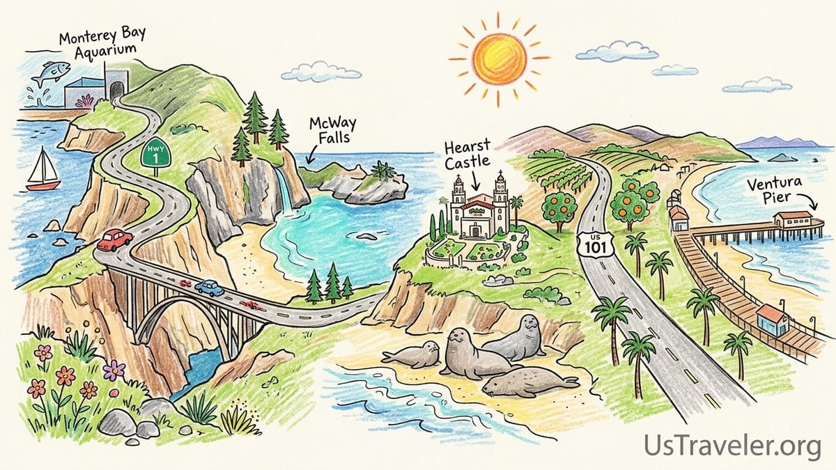
Understanding the Central Coast from Monterey to Ventura
For road trip planning, it helps to think of the Central Coast as a series of linked coastal subregions: Monterey Bay and Carmel, the Big Sur coast, the northern San Luis Obispo County stretch around San Simeon and Cambria, the Morro Bay and San Luis Obispo area, the classic beach towns of Pismo and the Five Cities, and finally the Santa Barbara Channel towns of Santa Barbara, the Santa Ynez Valley just inland, and Ventura. Highway 1 and US 101 weave between these zones, sometimes hugging sea cliffs and sometimes cutting inland through ranchland and towns.
Highway 1 between Carmel and San Simeon is the famous Big Sur Coast Highway. It is slower, narrower and far more winding than US 101, with frequent 25 to 35 mile per hour curves and minimal passing opportunities. Average real-world speeds often hover around 30 to 35 miles per hour, so the roughly 90 mile section between Carmel and San Simeon commonly takes three hours or more, even without construction delays or photo stops. US 101, by contrast, is a divided highway for long stretches and is the faster inland option between Monterey County and San Luis Obispo County.
Highway 1 also leaves the immediate coastline at several points. South of Morro Bay it turns inland past San Luis Obispo and rejoins the sea near Pismo Beach. Between Pismo and Santa Maria, and again from Gaviota to Oxnard, the primary coastal route is US 101, which tracks the shoreline for long stretches but sometimes sits slightly inland behind dunes or bluffs. You still see the ocean in many sections, but it is not a constant cliff-edge drive like central Big Sur.
As of October 2026, Highway 1 through the Regent’s Slide area of Big Sur has officially reopened after multi-year repairs, restoring through travel between Carmel and Cambria. However, Caltrans and local agencies continue to warn that rockfall, winter storms and wildfire operations can trigger new short-notice closures. Travelers should check the Caltrans QuickMap service and the Big Sur highway conditions page on the morning of departure, and again before committing to the long no-services stretch between Carmel and Ragged Point.
Current 2026 Access: Closures, Controls and Safe Planning
The 2023 to 2026 period saw repeated closures of Highway 1 in the Big Sur region, including a lengthy shutdown at Regent’s Slide and intermittent emergency closures due to rockslides and debris flows. In September 2025 Caltrans projected a reopening by early 2026, and the final blocked segment reopened to through traffic in January. Subsequent winter storms in February 2026 led to temporary closures and rock removal, and firefighting operations in summer 2026 again limited access through portions of Big Sur for days at a time. The pattern is clear: even when the highway is technically open, short-term disruptions remain a realistic possibility.
Because of this volatility, any Highway 1 road trip plan should include two habits. First, always confirm conditions on Caltrans QuickMap just before departure from Monterey, Carmel or Cambria, and zoom in on the Regent’s Slide, Paul’s Slide and Rocky Creek Bridge areas, which have been frequent trouble spots. Second, build in extra drive time on Big Sur days and avoid hard commitments, such as nonrefundable afternoon tours, scheduled for the same day you attempt to transit the cliffs.
McWay Falls in Julia Pfeiffer Burns State Park is another area with ongoing restrictions in 2026. The classic McWay Falls Overlook Trail has been closed for a long-term retaining wall repair project that state parks expects to run into 2026, and recent updates confirm that access remains limited. Visitors can still glimpse the 80-foot waterfall dropping onto the beach from a small highway-side viewing area, but there is no legal beach access and off-trail scrambling is strictly prohibited. Travelers who have seen older guidebooks describing a short overlook loop should be prepared for partial closures and obey on-site signage.
Elsewhere, many Central Coast attractions remain fully accessible. Hearst Castle above San Simeon is operating its standard schedule with multiple daily tours. The Piedras Blancas Elephant Seal Rookery north of San Simeon offers free parking and viewing pullouts overlooking hundreds of massive marine mammals in peak seasons. However, some state park campgrounds and trails in Big Sur have rolling fire or storm-related closures, so it is wise to check individual park pages or call Big Sur Station before banking on specific hikes.
Five-Day Highway 1 Itinerary: Monterey to Santa Barbara
The five-day version of this road trip assumes you want to prioritize Monterey, Carmel, Big Sur, the San Simeon and Cambria area, San Luis Obispo County, and Santa Barbara. It is designed as a one-way journey from north to south, starting in Monterey and ending in Santa Barbara, with a mix of scenic drives and two-night stays to reduce hotel hopping.
On Day 1, arrive in Monterey and base yourself near Cannery Row or downtown. If you are flying into Monterey Regional Airport, compact rental cars currently average around 40 to 50 dollars per day, with deals occasionally dropping into the mid 30s in the off-season according to recent booking data. San Jose and San Francisco airports usually offer slightly lower average daily prices for the same class, often close to the upper 50 dollar range, but the savings can be offset by the extra two to three hours of drive time to reach Monterey. Spend the afternoon exploring Monterey Bay, including the waterfront and, if budget allows, the Monterey Bay Aquarium, then overnight in Monterey, where midrange hotels commonly run from 180 to 260 dollars per night in 2026.
Day 2 runs from Monterey and Carmel to a Big Sur base. Start with an early breakfast in Monterey or Carmel and aim to leave Carmel by 9 am to enjoy relatively lighter traffic along Highway 1. Stop at Point Lobos State Natural Reserve just south of Carmel, where a modest day-use fee per vehicle grants access to spectacular headland trails and sheltered coves. Continue south to Bixby Creek Bridge, one of the most photographed spots on the Central Coast, and use the signed turnouts rather than improvising roadside parking, because new no-parking zones and enforcement have been introduced near the bridge. Reach your Big Sur lodging area by midafternoon; depending on your budget this might be a rustic cabin or inn in the Big Sur River valley or a lodge closer to Pfeiffer Big Sur State Park. Expect to cover about 30 to 40 miles of driving, but with viewpoints and stops this easily fills a full day.
On Day 3, drive the heart of Big Sur from your Big Sur base to San Simeon and Cambria, a distance of roughly 70 to 80 miles. Allow at least three to four hours of drive time plus extra for photo stops. If McWay Falls access is partially restricted during your visit, substitute additional time at Pfeiffer Beach, where a narrow access road off Highway 1 leads to a broad sandy cove with purple-streaked sand and the famous Keyhole Rock sea arch. Parking at Pfeiffer Beach requires a separate day-use fee collected by the US Forest Service. Continue south past Ragged Point and arrive in San Simeon by late afternoon. Overnight in Cambria or San Simeon; midrange properties often fall in the 160 to 230 dollar range, more for oceanfront rooms.
Day 4 takes you from Cambria through San Luis Obispo County to Pismo Beach. Start with a morning tour at Hearst Castle, whose ticketed tours for adults currently run in the mid 30 dollar range, plus a small online reservation fee per transaction. Book in advance for summer weekends. After your tour, stop a few miles north of San Simeon at the Piedras Blancas Elephant Seal Rookery, where free parking and boardwalk-style viewpoints make it easy to watch the animals without disturbing them. Then drive south through Cambria and Cayucos to Morro Bay, pausing at the Embarcadero for lunch and views of volcanic Morro Rock at the harbor mouth. From Morro Bay, Highway 1 briefly runs inland and merges toward US 101 near San Luis Obispo. Continue to Pismo Beach or neighboring Shell Beach for the night, with total driving around 90 miles and two to three hours of pure wheel time.
On Day 5, complete the route by driving from Pismo Beach to Santa Barbara along US 101, which follows the coast intermittently past Guadalupe Dunes, Santa Maria and the Gaviota Coast. The distance is about 75 to 90 miles, taking around two hours of drive time without stops. In Santa Barbara, stroll Stearns Wharf at the end of State Street for classic harbor views and casual seafood, or walk the beachfront promenade between the wharf and East Beach. You can end your trip in Santa Barbara, returning a rental car at Santa Barbara Airport where average compact rental rates typically sit in the upper 50 dollar per day range, or continue another day down to Ventura if you have extra time.
Seven-Day Highway 1 Itinerary: Adding Santa Cruz, Morro Bay, Santa Ynez and Ventura
The seven-day version of this trip adds Santa Cruz at the north end, a fuller Morro Bay stop, time in the Santa Ynez Valley wine country, and a final night in Ventura. It works well either as a one-way journey or a loop beginning and ending in a major city like San Jose or Los Angeles, but here it is presented simply as a north to south progression.
Day 1 begins in Santa Cruz, an easy hour and a half drive from San Jose on Highway 17 and Highway 1. If you need a rental car, San Jose International Airport often posts average compact prices around the upper 50 dollar per day mark in recent months, slightly less than in Los Angeles. Spend the day enjoying Santa Cruz’s classic boardwalk, West Cliff Drive and the surf breaks along Pleasure Point, then overnight in town. Midrange hotels here often range from 170 to 240 dollars per night in 2026, with seasonal peaks in summer.
On Day 2, drive from Santa Cruz to Monterey and Carmel, a distance of roughly 45 miles along Highway 1, which mostly stays close to the shore past farm fields and dunes. Take time to walk the seaside path at Pacific Grove or explore downtown Carmel’s galleries and restaurants. Consider staying in Carmel this night for an easy early departure into Big Sur the next morning, although Monterey remains a solid base if you prefer more dining options and attractions like the aquarium.
Day 3 follows the Big Sur routing from Carmel through Bixby Creek Bridge, Point Lobos and the Big Sur valley, with overnight in Big Sur as in the five-day itinerary. With the extra time afforded by a seven-day schedule, you can plan a longer hike in one of the local state parks, but as of late 2026 several trails and campgrounds have intermittent wildfire and slide-related closures. Stop in at Big Sur Station to ask about open routes to coastal viewpoints and redwood groves. Keep your driving distance to around 40 miles to leave room for hiking and beach visits.
Day 4 covers the coastal stretch from Big Sur to San Simeon and Cambria, with key stops at McWay Falls’ highway overlook, Julia Pfeiffer Burns State Park’s accessible areas, and Ragged Point. Once you reach San Simeon, visit the Piedras Blancas rookery either this afternoon or early the next morning, depending on light and timing. Many travelers choose Cambria as their base for two nights to slow the pace and enjoy the walkable Moonstone Beach boardwalk and compact downtown full of cafes and wine tasting rooms.
On Day 5, drive the short 35-mile hop from Cambria to Morro Bay and make it a low-mileage day centered on the harbor. Take the Bayshore Bluffs or Embarcadero waterfront paths for shifting views of Morro Rock, watch kayakers and otters in the estuary, and consider an easy bay cruise if the weather is calm. Dinner might be casual fish and chips along the Embarcadero or a slightly more upscale seafood restaurant overlooking the harbor. Overnight in Morro Bay or in nearby San Luis Obispo if you prefer a larger downtown with more nightlife and dining; the extra inland drive is only about 15 minutes.
Day 6 leads from Morro Bay or San Luis Obispo into the Santa Ynez Valley and then to Santa Barbara. Take US 101 south, which pulls away from the ocean between Pismo Beach and Gaviota Pass but offers faster travel on a divided highway. Exit toward Solvang and Los Olivos to sample the valley’s vineyards, Danish-inspired storefronts and ranchland scenery. Many tasting rooms in downtown Solvang and Los Olivos offer walk-in tastings in the 20 to 30 dollar range, though some require reservations on weekends. Continue over the San Marcos Pass or along US 101 back to the coast and reach Santa Barbara by late afternoon, where you can spend the evening along Stearns Wharf and the Funk Zone arts and tasting district.
On Day 7, complete the journey with a relaxed 30-mile drive from Santa Barbara to Ventura along US 101, which hugs the shoreline for much of this segment. This is a relatively quick trip, often under an hour of wheel time, but you may want to build in stops at beaches like Carpinteria State Beach or Rincon Point to watch surfers. In Ventura, walk the historic downtown centered on Main Street, visit the Ventura Pier and promenade, or climb up to Grant Park for a panoramic view over the coastline and Channel Islands on clear days. If you are returning a rental car in the Los Angeles area, allow at least two additional hours to reach the LAX rental car center from Ventura, plus buffer for traffic.
Driving Conditions, Timing and When to Use US 101 Instead of Highway 1
Even in perfect weather, Highway 1 is significantly slower than US 101 on most Central Coast segments. Between Santa Cruz and Monterey, where Highway 1 functions as a four-lane divided highway bypassing Watsonville and Castroville, the difference is modest. South of Carmel, however, the route narrows to two lanes and clings to steep cliffs, with many blind curves and limited sight lines. A realistic planning speed through Big Sur is 30 to 35 miles per hour including occasional delays. This means that driving the 90 or so miles from Carmel to San Simeon often takes three hours without long stops, and four or more with viewpoint breaks.
US 101 is the better choice when you need to make time between regions, for example from Monterey or Salinas to San Luis Obispo, or from Pismo Beach to Santa Barbara. In these sections the inland freeway-style road bypasses small towns and offers higher speed limits. For instance, the 120-mile run from San Luis Obispo to Santa Barbara on US 101 can be done in about two hours, whereas a more coastal meander that detours frequently to beaches and towns can double that in practice.
Several parts of Highway 1 leave the immediate coast. Between Morro Bay and San Luis Obispo, the signed Highway 1 alignment turns inland through ranchland and merges eventually with US 101, so travelers seeking constant ocean views sometimes choose to linger on back roads near the shore before rejoining the main route. South of Pismo Beach, US 101 usually runs a short distance inland, with dunes and agricultural land between the highway and the sea, although there are still ocean glimpses and easy detours to coastal state beaches.
Departure timing matters on this road trip. Starting earlier in the morning not only reduces traffic but also improves the chances of clear views before afternoon marine layer fog thickens, particularly in late spring and early summer. Aim to leave bases like Monterey, Carmel or Cambria by 8 or 9 am on major drive days, and avoid setting out through Big Sur late in the day when tiredness and low sun glare can make the twisting road more stressful.
Key Sights, Food Stops and Where to Sleep
Some Central Coast stops are nearly mandatory for first-time visitors. Point Lobos State Natural Reserve near Carmel offers some of the best short coastal hikes in the region, with trails threading through Monterey cypress groves and around turquoise coves. Parking can fill quickly on weekends, so arriving before mid-morning helps. Bixby Creek Bridge, further south on Highway 1, is best appreciated from the official north and south turnouts with care taken to stay behind guardrails; informal dirt pullouts have increasingly been blocked off or posted due to erosion and safety concerns.
McWay Falls remains iconic even with restricted trail access. Plan for a brief stop rather than a long hike and be prepared for limited legal viewing space along the highway. Pfeiffer Beach, accessed via Sycamore Canyon Road off Highway 1, offers a more expansive beach experience, but the road is narrow and the small parking lot sometimes closes temporarily when full. Arriving earlier in the day or visiting outside peak summer weekends can reduce frustration.
Farther south, Hearst Castle is a highlight both for architecture and for its hillside views over San Simeon and the coast. Tours are ticketed and priced in the mid 30 dollar range for adults, including a timed shuttle ride from the visitor center up to the estate. Many travelers combine a morning castle tour with an afternoon stop at the free Piedras Blancas Elephant Seal Rookery, seven to eight miles north of San Simeon along Highway 1, where interpretive signs and volunteer docents often help explain the seals’ seasonal behavior.
For food and overnights, each region offers a spectrum of choices. In Monterey and Santa Cruz you will find everything from budget motels around 120 to 150 dollars per night to boutique inns above 300 dollars. In Big Sur, lodging is more limited and expensive because of the small number of properties and high demand; simple cabins can start around the mid 200 dollar range in busy seasons, while upscale resorts run much higher. Cambria, Morro Bay and Pismo Beach provide a middle ground, with plentiful midrange hotels and motels in the 160 to 230 dollar bracket. Santa Barbara and Ventura offer both chain hotels near the freeway and higher-end beachfront properties; in 2026, it is common to see central Santa Barbara rooms above 300 dollars per night on weekends, while Ventura often comes in closer to 180 to 240 dollars for midrange stays.
Rental Car Choices, Trip Budgets and Backup Routes
For a Monterey to Ventura road trip, most travelers will either rent a car in Northern California and drop it in Santa Barbara or Los Angeles, or reverse the direction. Recent pricing comparisons show that Monterey Regional Airport often has compact rental rates averaging around 45 dollars per day for week-long bookings, based on data gathered over the past year. San Jose and San Francisco airports trend a little higher in headline averages but sometimes produce cheaper deals thanks to competition among larger fleets. Los Angeles International Airport and Santa Barbara Airport usually post averages in the upper 50 to low 60 dollar range for compact cars, though holiday and summer weekend surcharges can push prices well above that.
One-way drop fees remain common when starting in one airport and finishing in another, particularly when crossing between Northern and Southern California. These fees can range from modest to substantial, so it pays to compare quotes that start in Monterey or San Jose and end in Santa Barbara with alternatives that start in Los Angeles and end in Monterey. Some major rental chains sometimes waive drop fees on intra-California rentals during promotional periods, but those offers change too frequently to rely upon without checking current terms at booking time.
For a realistic total budget, consider a five-day midrange itinerary for two people starting in Monterey and ending in Santa Barbara. Car rental for five days at about 50 dollars per day comes to roughly 250 dollars, plus perhaps 80 to 120 dollars in fuel depending on vehicle and detours. Lodging at an average of about 220 dollars per night for four nights in Monterey, Big Sur or Cambria, Pismo and Santa Barbara totals around 880 dollars. Add roughly 120 to 150 dollars per day for food and modest activities, or about 600 to 750 dollars over five days, and a ballpark midrange budget lands around 1,800 to 2,000 dollars before major splurges. A seven-day version with Santa Cruz, Morro Bay, Santa Ynez and Ventura might add two more hotel nights and food days, pushing the estimate toward 2,500 to 3,000 dollars.
Backup routing is essential given Highway 1’s history of sudden closures. If a slide or rockfall shuts the Big Sur coast between Carmel and Ragged Point, the classic workaround is to leave Monterey on US 101 via Salinas and Paso Robles and approach Cambria and San Simeon from the inland side, then drive north on Highway 1 only as far as conditions allow. Another alternative is the Nacimiento-Fergusson Road, which connects Highway 1 south of Lucia to US 101 near Fort Hunter Liggett, but this route is steep, narrow and sometimes closed itself for storm or fire damage, so you should only consider it after verifying its status and if you are comfortable with mountain driving.
Farther south, if US 101 closes temporarily for rockfall or wildfire near the Gaviota Pass or Santa Barbara, temporary detours on local roads may be signed, but significant closures are comparatively rare and quickly publicized in regional news. In all cases, keeping plans flexible and checking conditions on the morning of each drive day is more effective than trying to predict exact closures weeks in advance, especially during the winter rainy season from roughly November through March.
The Takeaway
A Highway 1 road trip between Monterey and Ventura remains one of the most rewarding drives in California, but by 2026 it also demands more planning and flexibility than older guidebooks suggest. Big Sur’s cliffs are open again after major repairs at Regent’s Slide, yet the same geology that makes the road dramatic also makes it vulnerable to storms, rockfall and fire-related closures. Treat the highway as a scenic detour that you commit to only after checking live conditions on the day, not as a guaranteed through route.
If your time is limited, a five-day journey from Monterey to Santa Barbara delivers a strong mix of highlights: Monterey’s bay and aquarium, Carmel and Point Lobos, the Big Sur coast and Bixby Bridge, McWay Falls’ dramatic cove viewed from the highway, Hearst Castle and the elephant seals of Piedras Blancas, and finally Stearns Wharf and the palm-lined Santa Barbara waterfront. With a week, you can add Santa Cruz’s surf culture, a deeper stop in Morro Bay, the vineyards of the Santa Ynez Valley and a relaxed final evening in Ventura watching the sun drop behind the Channel Islands.
Within this framework, you can scale lodging, dining and rental car choices to match your budget, from modest motels to seaside boutiques and from compact sedans to roomier SUVs that offer more comfort on the twisting grades. Whatever you choose, combine conservative drive-time estimates, early departures, and a willingness to pivot inland to US 101 if needed. That way, even if the coast throws you a curve, you still end your trip with a string of memorable towns, beaches and viewpoints linked together along one of the state’s signature drives.
FAQ
Q1. Is Highway 1 fully open through Big Sur in late 2026?
As of October 2026, the long-closed Regent’s Slide section has reopened, restoring through travel between Carmel and Cambria, but short-notice closures due to rockfall, storms or wildfire operations still occur, so you must check Caltrans QuickMap just before you drive.
Q2. Can I still see McWay Falls if the main overlook trail is closed?
Yes. Even while the official overlook trail is under a long-term retaining wall repair project, travelers can usually see McWay Falls from a small viewing area along Highway 1, but there is no legal access to the beach and you should obey all closure signs and barriers.
Q3. How long does it really take to drive from Carmel to San Simeon on Highway 1?
Without long stops, the roughly 90 mile Big Sur segment typically takes about three hours in light traffic, and many travelers report four hours or more once photo stops, construction delays and slow vehicles are included.
Q4. When is US 101 a better choice than Highway 1 on this trip?
US 101 is preferable when you need to make time between major regions, such as from Monterey County to San Luis Obispo County or from Pismo Beach to Santa Barbara, because it is a faster inland highway with higher speed limits and fewer sharp curves.
Q5. How much should I budget for a five-day Monterey to Santa Barbara road trip for two?
A typical midrange budget for two people, including a compact rental car, fuel, four nights in midrange hotels, meals and a few paid attractions like Hearst Castle, often lands roughly between 1,800 and 2,000 dollars before airfare or major splurges.
Q6. Are the elephant seals at Piedras Blancas free to visit?
Yes. The Piedras Blancas Elephant Seal Rookery north of San Simeon has free parking pullouts and boardwalk-style viewpoints, though donations to local organizations that staff docents and maintain signage are encouraged.
Q7. Do I need a four-wheel-drive vehicle for Highway 1?
No. The main sections of Highway 1 and US 101 between Monterey and Ventura are paved roads suitable for standard passenger cars; four-wheel drive is only relevant for certain unpaved forest roads that most visitors can skip.
Q8. Is it better to start this road trip in Monterey, San Jose or San Francisco?
Starting in Monterey minimizes backtracking and keeps you close to the coast, while San Jose and San Francisco can offer slightly cheaper or more plentiful rental car options at the cost of a longer initial drive to reach Monterey Bay.
Q9. What are good backup plans if Highway 1 through Big Sur closes suddenly?
If Big Sur closes, you can reroute inland on US 101 via Salinas and Paso Robles to reach Cambria and San Simeon, then explore as much of Highway 1 as conditions allow from the south, or focus more time on San Luis Obispo County, Santa Ynez and Santa Barbara instead.
Q10. Which overnight combination works best for a seven-day trip from Santa Cruz to Ventura?
A balanced seven-day plan might include nights in Santa Cruz, Carmel or Monterey, Big Sur, Cambria, Morro Bay or San Luis Obispo, Santa Barbara and Ventura, keeping most individual drive days under three hours.